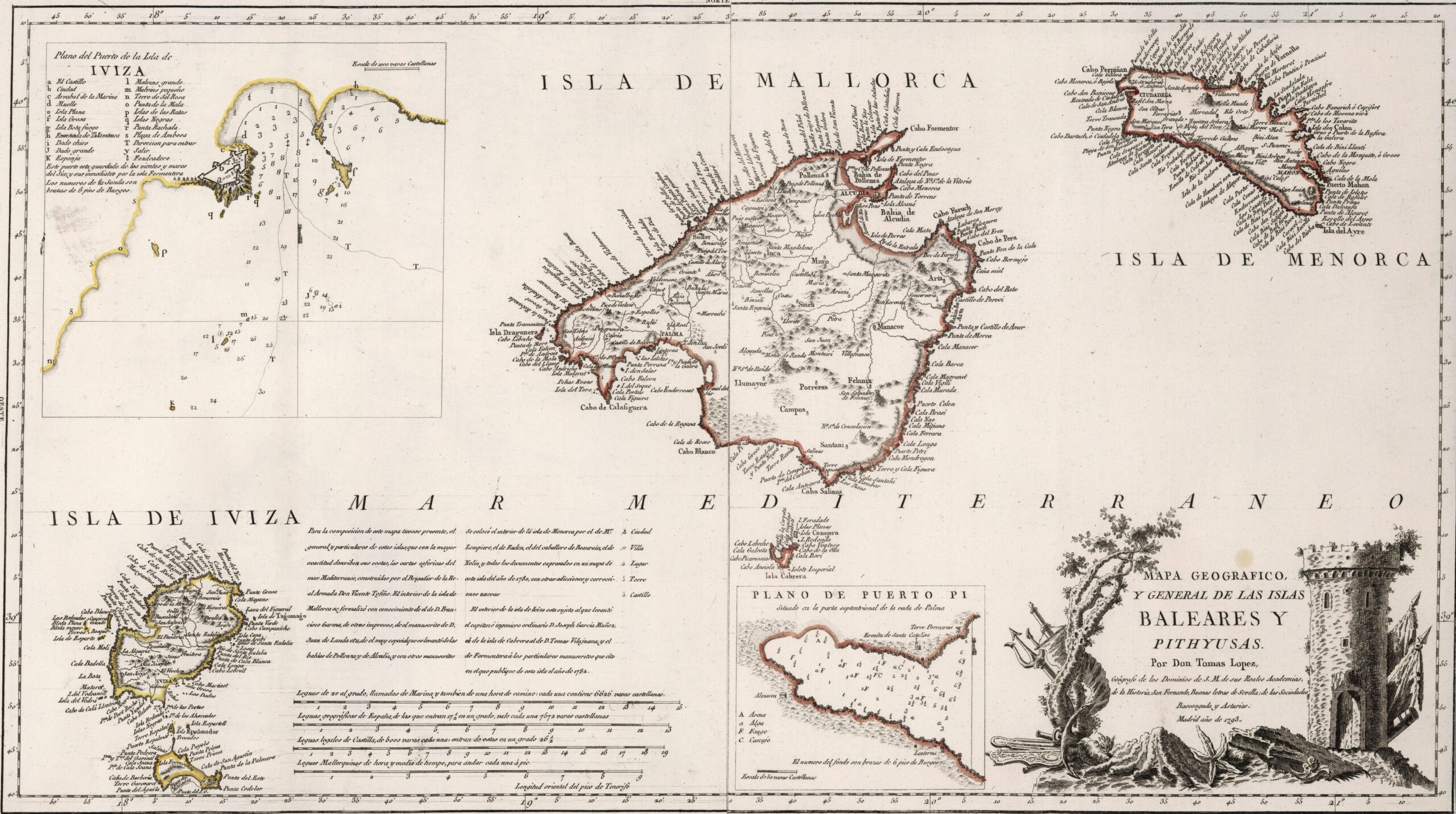
This map was created by Spanish cartographer Tomás López de Vargas Machuca in 1772 and published posthumously by his sons in the “Geographical Atlas of Spain” from 1804. The map depicts the Balearic Islands with the territorial boundaries prior to Javier de Burgos' provincial administration reform in 1833.
The author distinguishes between the Balearic Islands, in red, and the Pitiusas Islands, in yellow. This division comes from the Greek names for the islands, although the nomenclature is not entirely correct. While it is true that the Greeks called Ibiza and Formentera the Pitiusas, they reserved the name Gimnesias (and not Balearic) for Mallorca, Menorca and Cabrera.
Another interesting detail is how the author includes Menorca as part of the Spanish monarchy. In 1772, Menorca was under British rule for the second time (1763–1783), and it did not become an integral part of Spain until 1802.
The administrative division of the Balearic Islands had two distinct districts: Ibiza and Majorca. The rest of the islands and islets were assigned to one district or the other. The map also shows a detail of the port of Ibiza and another of Puerto Pi, south of Palma de Mallorca.
You can read more about Tomás López and his atlas in this article from the newsletter: Tomás López and the first detailed atlas of Spain (1804).
Sources

