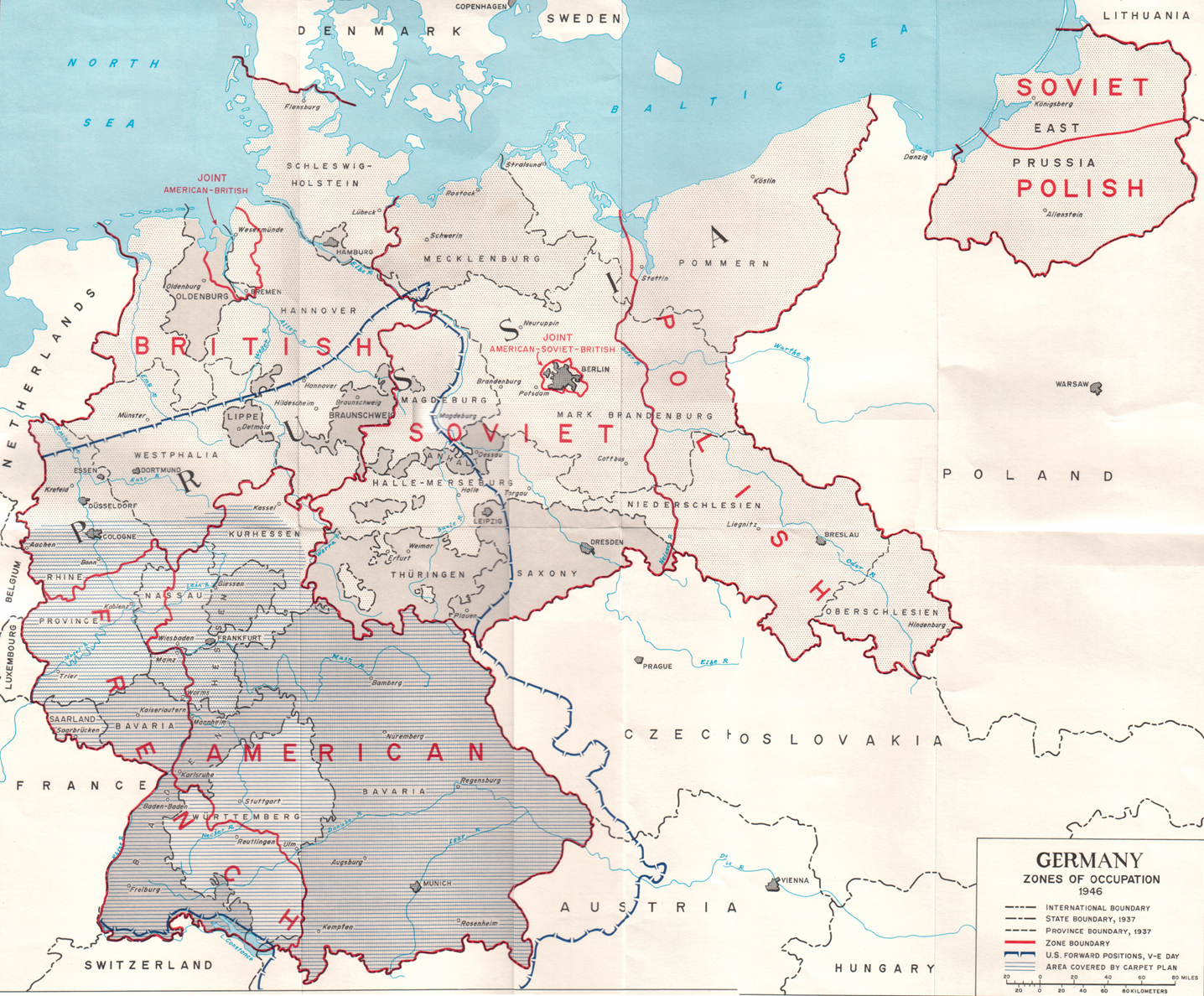
This map, created by the United States Army in 1946, depicts the partition of Germany among the various Allied powers after the end of the Second World War.
After all occupied territories had been returned to their original countries, as in the case of Czechoslovakia and Austria, the Potsdam Conference took place, at which Nazi Germany's territory was divided as follows:
- Poland obtains southern West Prussia.
- The Soviet Union obtains northern West Prussia, which becomes the enclave of Kaliningrad.
- The Oder-Neisse line is established, with the area east of it becoming part of Poland.
- The United Kingdom, the United States and France divided control of southern and western Germany, which would eventually be unified to form the new country of West Germany.
- The Soviet Union takes control of the western part of the Oder-Neisse line, which would become the German Democratic Republic or East Germany.
- Bremen came under joint administration by the United Kingdom and the United States and would become part of West Germany.
- Berlin came under the joint administration of the United States, the Soviet Union, France and the United Kingdom, which led to the division of the city into two parts and, a few years later, the construction of the Berlin Wall.
Sources

