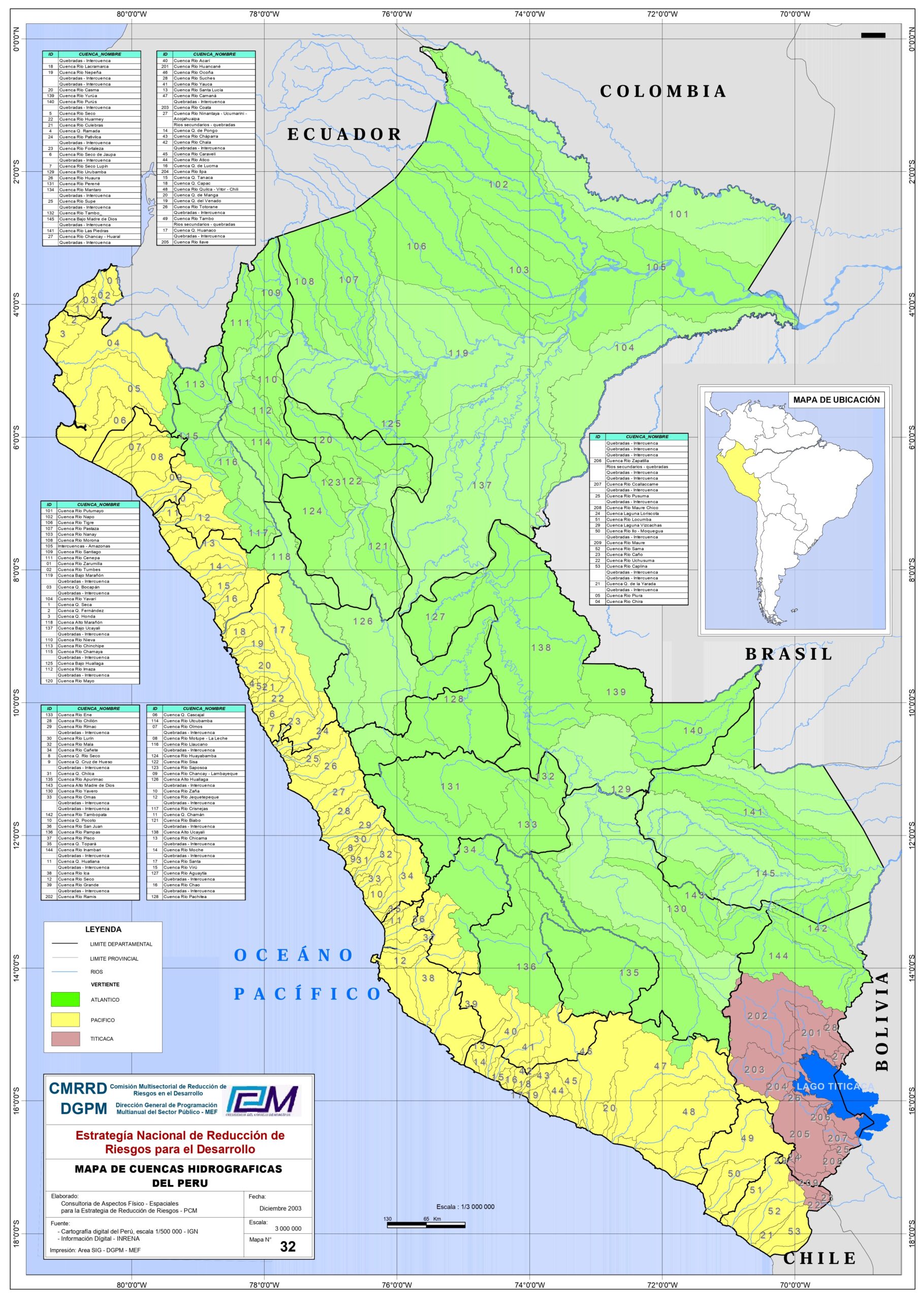
This map, produced in 2003 by a consulting firm at the request of the Presidency of the Council of Ministers of Peru, shows the map of Peru's river basins.
The map is divided into small hydrographic regions that are numbered, with a legend that includes the name of each of these regions. Three colours are used on the map to delimit the three watersheds of the country:
- Yellow: Rivers that flow into the Pacific Ocean. The hydrographic regions belonging to this watershed are numbered from 1 to 53.
- Green: Rivers flowing into the Atlantic Ocean. The hydrographic regions belonging to this watershed are numbered from 101 to 144.
- Purple: Rivers that form part of the endorheic basin of Lake Titicaca. The hydrographic regions belonging to this watershed are numbered from 201 to 209.
Although there are many rivers that flow into the Pacific Ocean and Lake Titicaca, all the rivers that flow into the Atlantic basin shown on the map are tributaries of the Amazon River. The Amazon River leaves Peru at the Tres Fronteras, the point where Brazil, Colombia and Peru meet (region 105). Other important tributaries of the Amazon that also appear on the map are the Putumayo River (region 101), the Ucayali River (regions 137 and 138), the Madre de Dios River (regions 143 and 145) and the Purús River (region 140).
Sources

