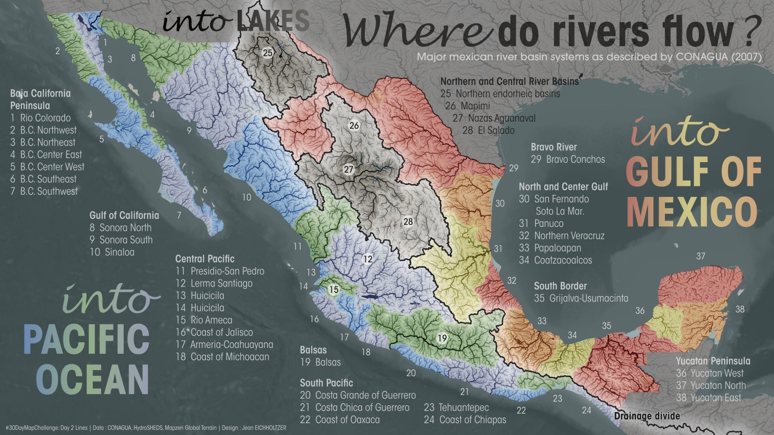
This map was published Jean Eichholtzer in 2023 as part of the initiative #30DayMapChallenge.
The map shows the river basins of Mexico. All of them are numbered, with a legend that includes the name of each region. In addition, the illustration uses a series of colours to delimit the main watersheds:
- Warm colours (red, yellow and orange): Rivers that flow into the Atlantic Ocean.
- Cool colours (blues and greens): Rivers that flow into the Pacific Ocean.
- Grey: Endorheic basins, those without an outlet to the ocean.
The black line running from north to south represents the watershed between the two oceans.
You can find more information about the initiative here. #30DayMapChallenge in what I wrote in the newsletter.
Sources

