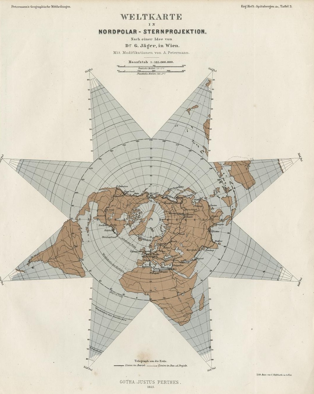
This map, published by German cartographer August Heinrich Petermann in 1865, shows the world using a polar projection conceptualised by Austrian G. Jäger.
This projection uses a standard polar projection for the northern hemisphere, but represents the southern hemisphere using triangles, each covering one-eighth of the southern hemisphere.
In addition, the map also shows the telegraph lines that existed in the world at that time. It includes the telegraph line across the Atlantic Ocean, even though it was not operational in the year this map was published.
You can read more about map projections in this newsletter article: Cartographic projections: distorting the Earth in order to represent it
Sources
- World map in North Polar Star projection based on an idea by Dr G. Jäger, Vienna
- 1865 Petermann North Polar Projection, World Telegraph Lines

