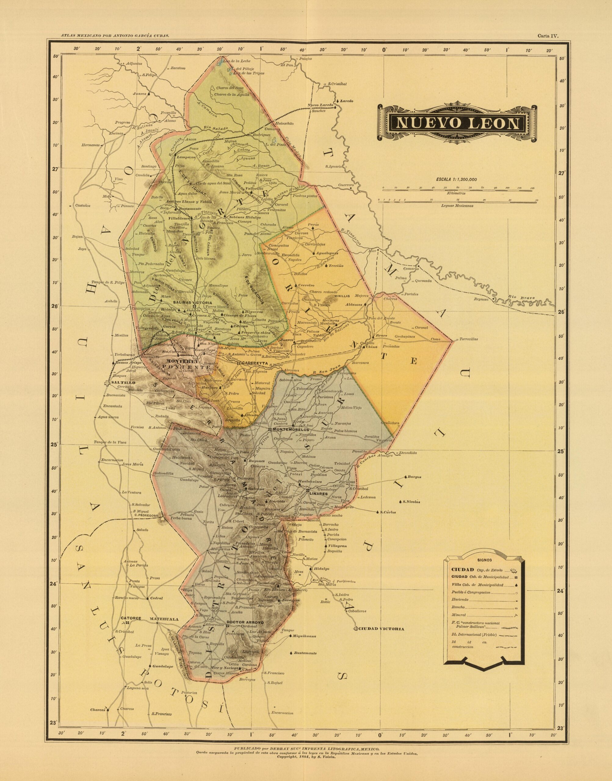
This map, drawn by the Mexican cartographer Antonio García Cubas, was originally published as part of the Atlas geográfico y estadístico de...
Maps of Mexico (34 maps)

Map of Mexico – New Spain (1818)
This map was published by Mathew Carey in 1818 as part of Carey's General Atlas. In...

Rainfall map of Mexico (2023)
This map was published by Jean Eichholtzer in 2023 as part of the #30DayMapChallenge initiative. The map shows annual rainfall in each region...

Population density of Mexico (2023)
This illustration, created by Terence Teo, represents Mexico's population density on a three-dimensional map. To do this, ...

All roads lead to Mexico City (2023)
This map was published by Dolly Andriatsiferana in 2023 as part of the #30DayMapChallenge initiative. The map shows all the roads from the...

Map of the state of Tabasco, Mexico (1886)
This map, drawn by the Mexican cartographer Antonio García Cubas, was originally published as part of the Atlas geográfico y estadístico de...
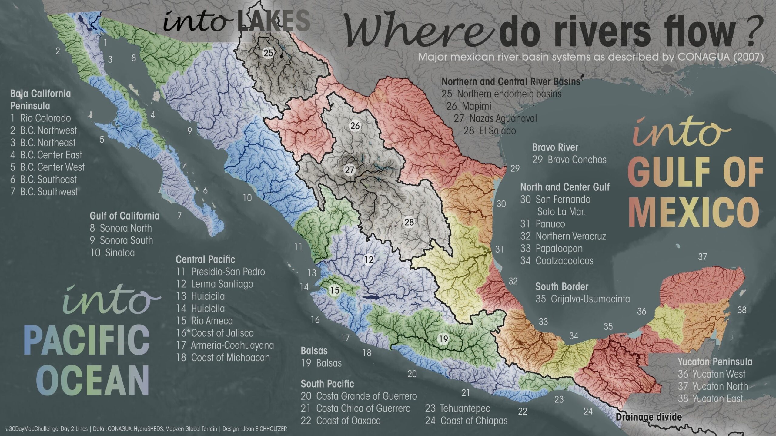
River basins of Mexico (2023)
This map was published by Jean Eichholtzer in 2023 as part of the #30DayMapChallenge initiative. The map shows the river basins of Mexico. All...
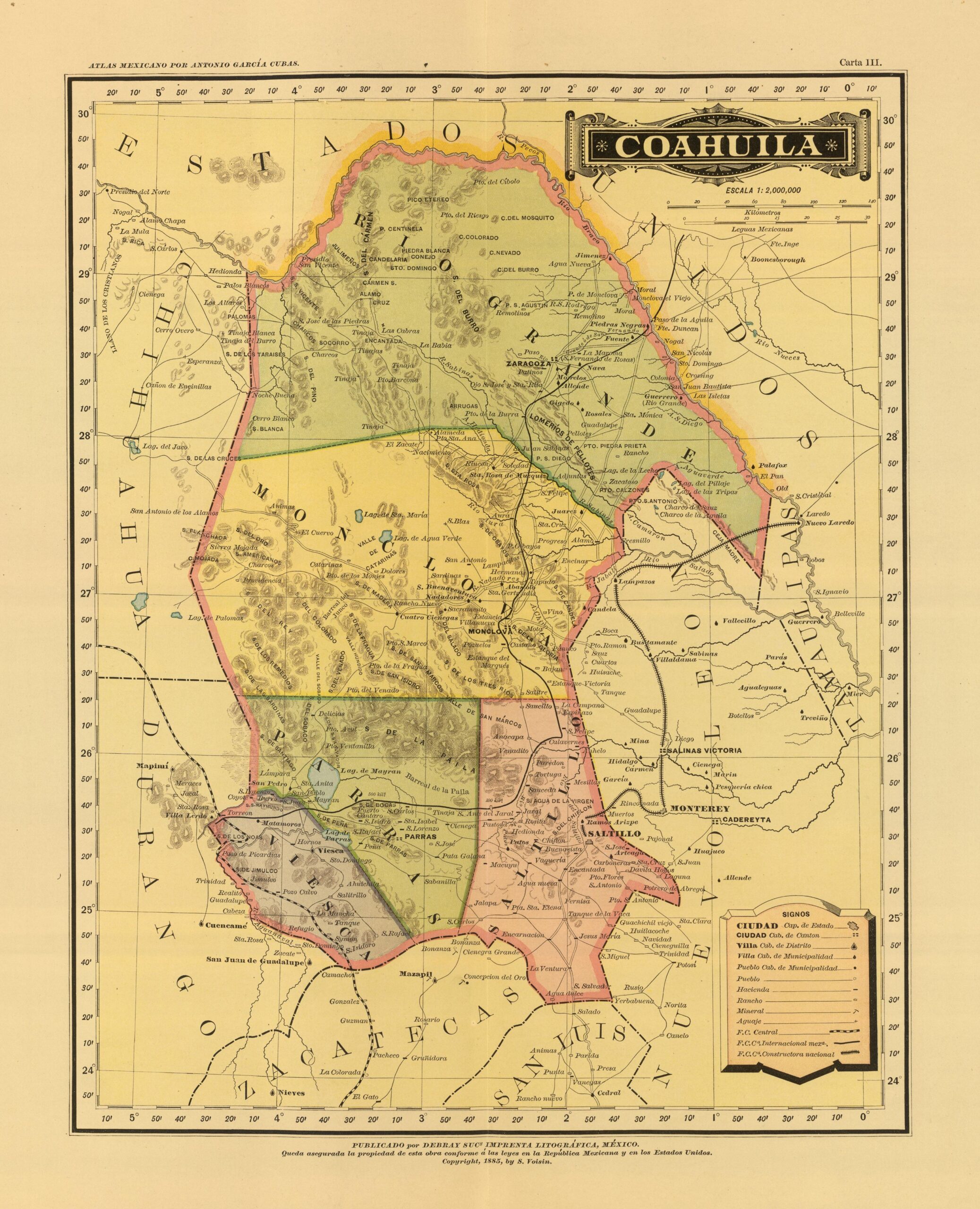
Map of the state of Coahuila, Mexico (1886)
This map, drawn by the Mexican cartographer Antonio García Cubas, was originally published as part of the Atlas geográfico y estadístico...

Map of Mexico (1831)
This map of Mexico was published by Anthony Finley as part of his 1831 atlas, ten years after...

Illustrated map of the Mexican Republic (1930)
This tourist map was drawn by Miguel Gómez Medina and published by Margaret M. Crane and Eugenio Fischgrund...

Map of the city of Monterrey (1791)
This map of the city of Monterrey was published in 1791. At that time, Mexico was not yet independent and...

Relief map of Mexico, by Miguel Valenzuela (2021)
This map, created by Miguel Valenzuela, shows the relief of Mexico. It uses three colours: green for areas...
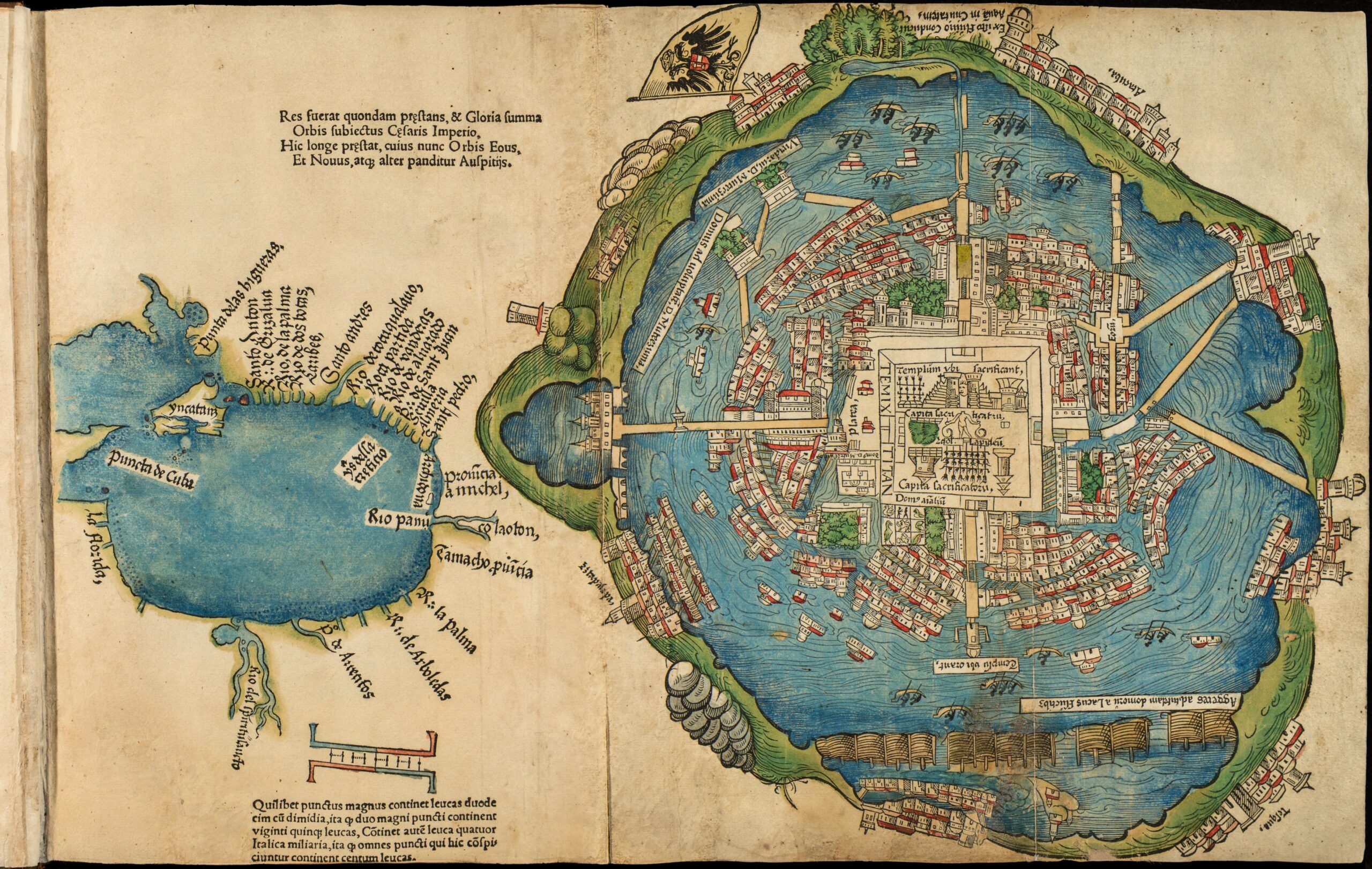
Map of Tenochtitlan (1524)
This map of Tenochtitlan is a German reproduction from 1524 of the map made by Hernán Cortés and sent to Charles...

New Granada and the Island of California (1666)
This map appeared in the first edition of De Zee Atlas ofte Water-Weereld (Atlas of the Sea or Water World).

Map of the state of Tamaulipas, Mexico (1886)
This map, drawn by the Mexican cartographer Antonio García Cubas, was originally published as part of the Atlas geográfico y estadístico de...

Literacy rate in Mexico (2020)
This map, published by Mexico's National Institute of Statistics and Geography (INEGI) in 2020, shows the index of...

Map of the state of Veracruz, Mexico (1886)
This map, drawn by the Mexican cartographer Antonio García Cubas, was originally published as part of the Atlas geográfico y estadístico de...

Mexico, in the style of World of Warcraft (2024)
This map, created by Santiago Reyes in 2024, depicts Mexico. The illustration is part of a project to depict all of Latin America...

Map of the state of Sonora, Mexico (1886)
This map, drawn by the Mexican cartographer Antonio García Cubas, was originally published as part of the Atlas geográfico y estadístico...

Tacografía, map of tacos in Mexico (2013)
This map was created by Kitzia Sámano for the gastronomic book La Tacopedia, published by the Mexican publishing house Trilce in...
 Español
 English (UK)