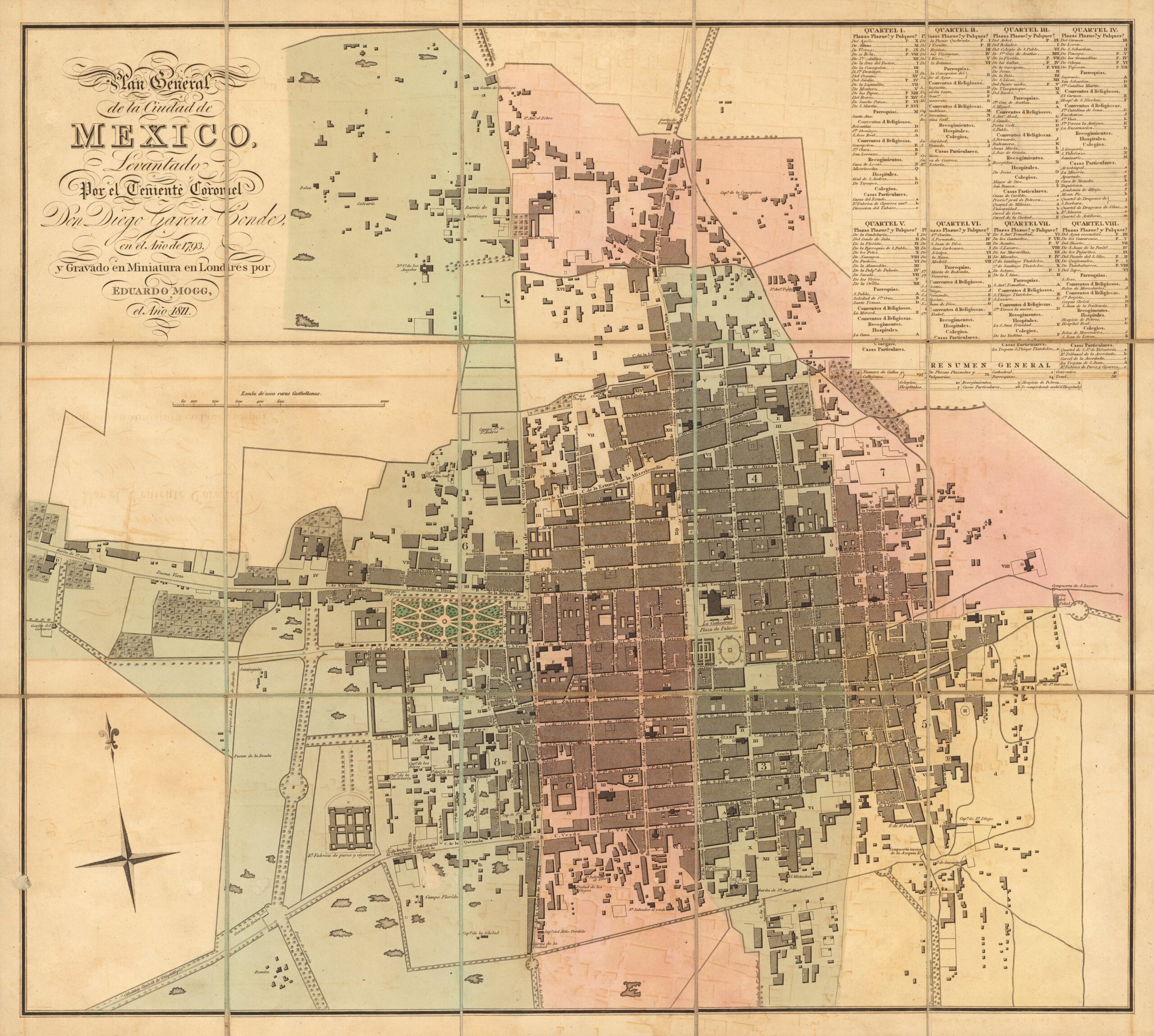
This map of Mexico City was drawn up in 1793 by cartographer Diego García Conde. This particular copy is an engraving published in 1811 in London by Edward Mogg.
Around 1800, the population of Mexico City was around 175,000, making it the largest city in the Kingdom of New Spain and one of the most important on the American continent.
The map shows the eight districts into which the city was administratively divided. The areas and parishes are marked in the upper right-hand corner, and these are also represented on the map in different colours:
- Barracks 6, in green, at the top left.
- Barracks 7, in pink, in the top right corner.
- Quarter 1, in yellow, in the upper left centre.
- Quarter 4, in blue, in the upper right-hand centre.
- Barracks 8, in blue, at the bottom left.
- Quarter 2, in pink, in the lower left centre.
- Barracks 3, in green, in the lower right-hand centre.
- Barracks 5, in yellow, at the bottom right.
The map already shows some of the city's most characteristic landmarks, such as the former Royal Palace (now the National Palace) in Quarter 4, and the Alameda Central in Quarter 1. Most of the city's monuments and landmarks were built after independence from Spain in 1821.
Sources

