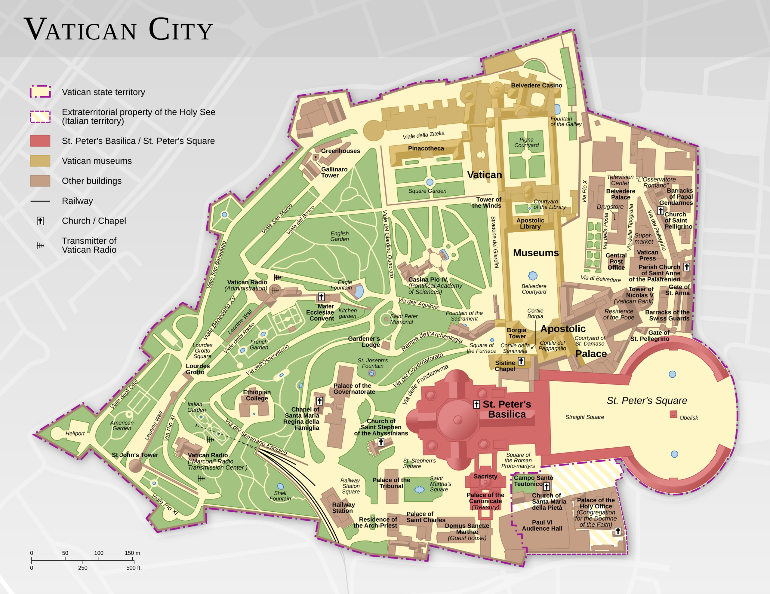
This map, created by Thoroe for Wikimedia Commons, shows Vatican City, the smallest country in the world.
Vatican City is located within the city of Rome, and its borders are marked on the map with a purple line. In total, it covers an area of only 44 hectares. In the lower right-hand corner of the map, there is a small area that belongs to Rome, although it is owned by the Vatican.
On the map, St. Peter's Cathedral is marked in red and can be accessed freely from Rome. The country's other major tourist attraction, the Vatican Museums, is marked in yellow. The rest of the buildings are marked in brown and the gardens in green.
Sources

