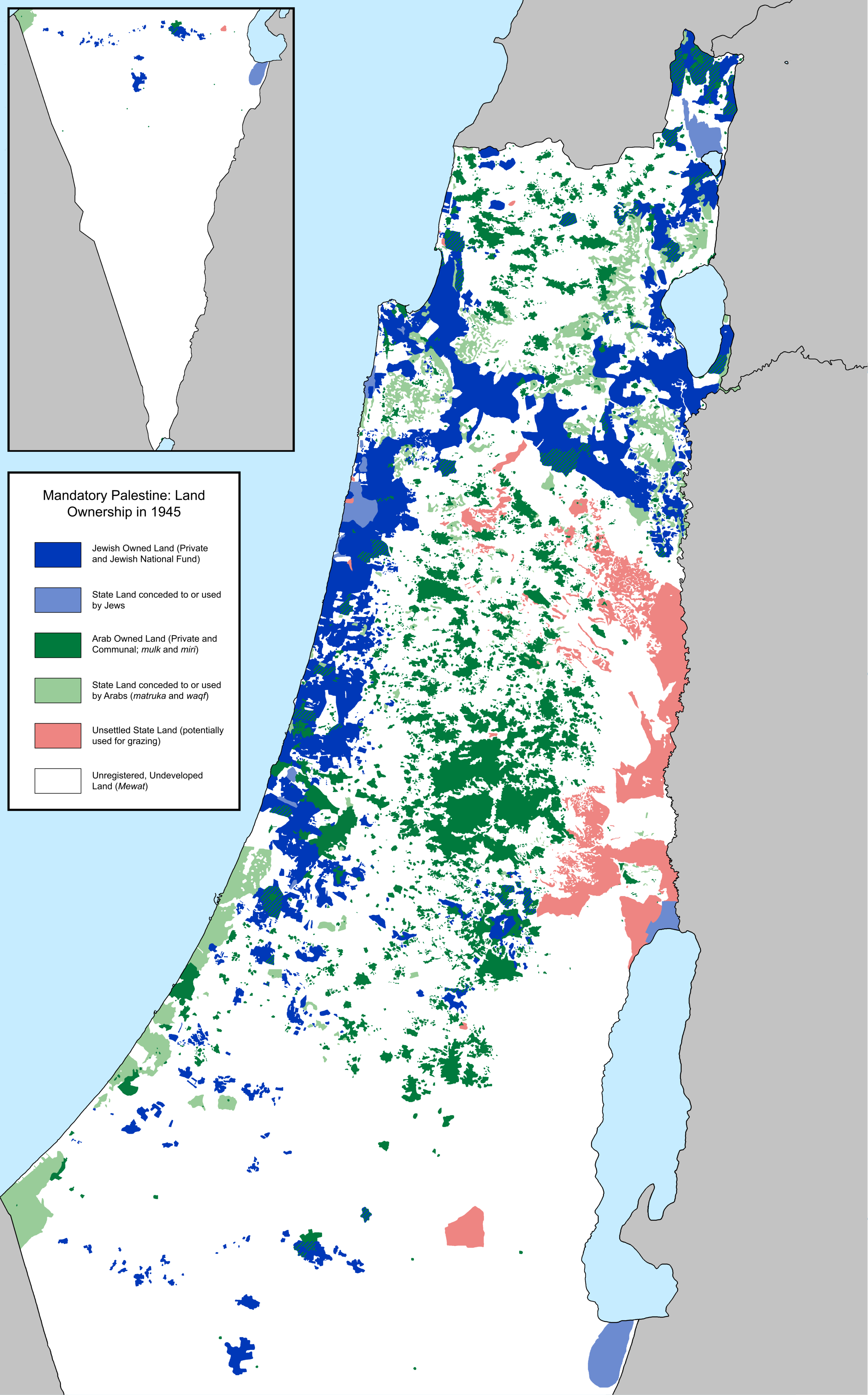
This map, created by Reddit user Shahanshah26 in 2020, shows the situation of land ownership in the Mandate of Palestine in 1945, at the end of the Second World War and before the formation of the State of Israel.
For several centuries, the number of Jews living in Palestine was insignificant, but that changed in the late 19th century, when nationalism led to the emergence of Zionism and various associations were organised to help Jews from around the world begin to buy land in Palestine and settle there.
This led to several clashes between the Arabs who were already settled there and the newly arrived Jews, all within a Palestine that was still part of the British Empire. The tension reached such a point that Arab leaders asked the United Kingdom to curb Jewish immigration, but at the same time, the British Empire had promised to help the Zionists create the state of Israel.
As a result, at the end of the Second World War, land ownership showed a great divide between Jews and Palestinians, as shown on the map:
- In dark green, all the territory that was privately owned by Palestinian Arabs.
- In light green, the territory populated by Palestinian Arabs, but owned by the Mandate of Palestine.
- In dark blue, all the territory that was privately owned by Jews.
- In light blue, the territory populated by Jews, but owned by the Mandate of Palestine.
- In red, the territory that was not yet settled.
This division of land ownership and settlements was key in defining the new state of Israel in 1948, with borders determined by the United Nations in 1947.
The data used by the author is mainly obtained from the survey of the Mandate of Palestine carried out in 1945 and 1946 by British and American authorities (PDF), although it is corroborated by other sources: Chronology of Jewish settlements (PDF),
Sources

