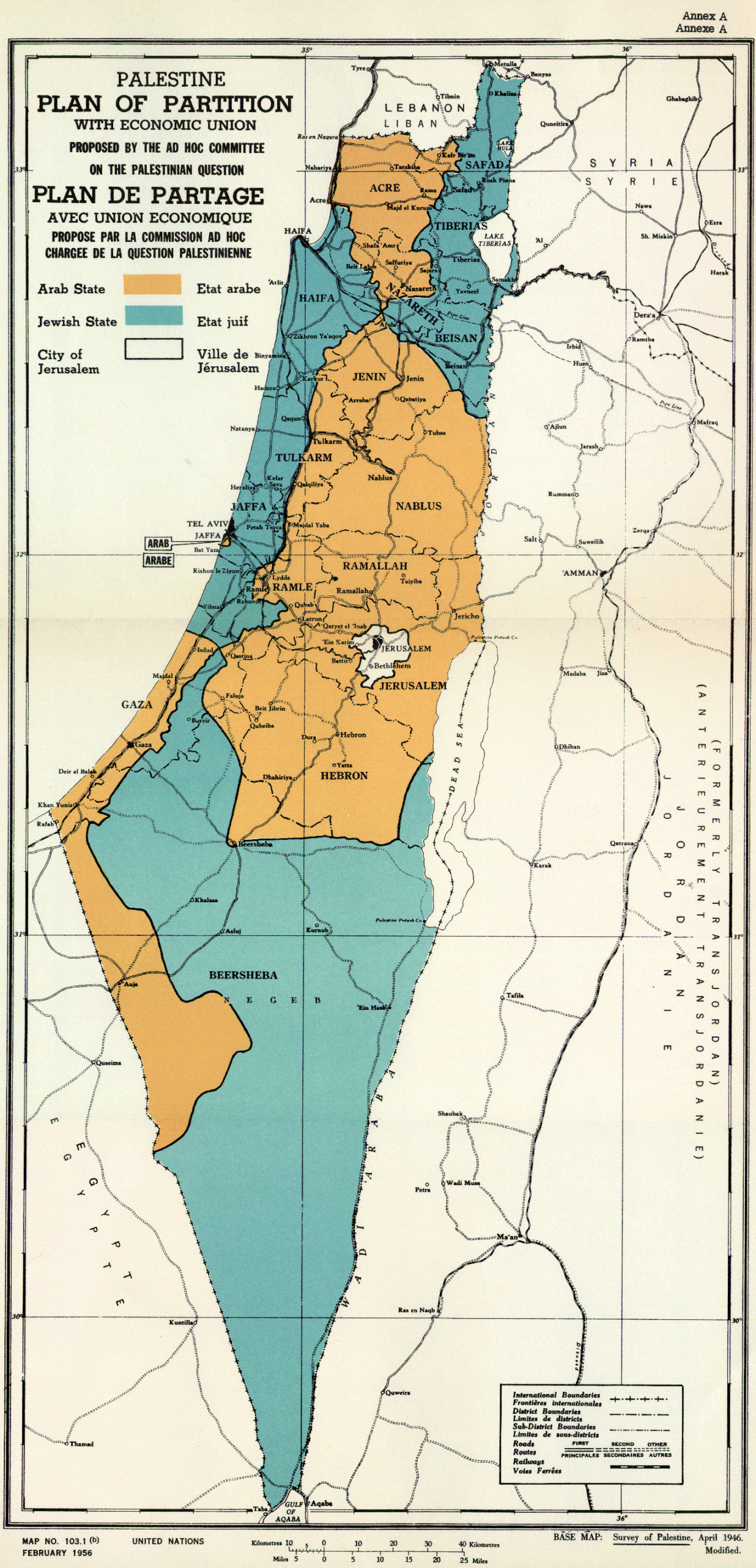
This map was originally published by the United Nations (UN) in 1947 as an annex to Resolution 181 (II). This copy includes some minor modifications that were published in 1956, as indicated in the lower left corner.
This UN resolution addressed the end of the British Mandate for Palestine and the creation of the independent states of Israel and Palestine, as well as the creation of the Separate corpus, which encompassed Jerusalem and its surroundings, with an international mandate given its religious significance:
- The entire territory designated for Israel is marked in blue, divided into three regions.
- The territory assigned to Palestine is shown in orange, also divided into three regions.
- In white, like an enclave within Palestine, Jerusalem and the Separate corpus.
These borders came into effect in 1948, after which a war broke out between Israel and the Arab countries, following which the borders proposed by the UN were redefined.
Sources

