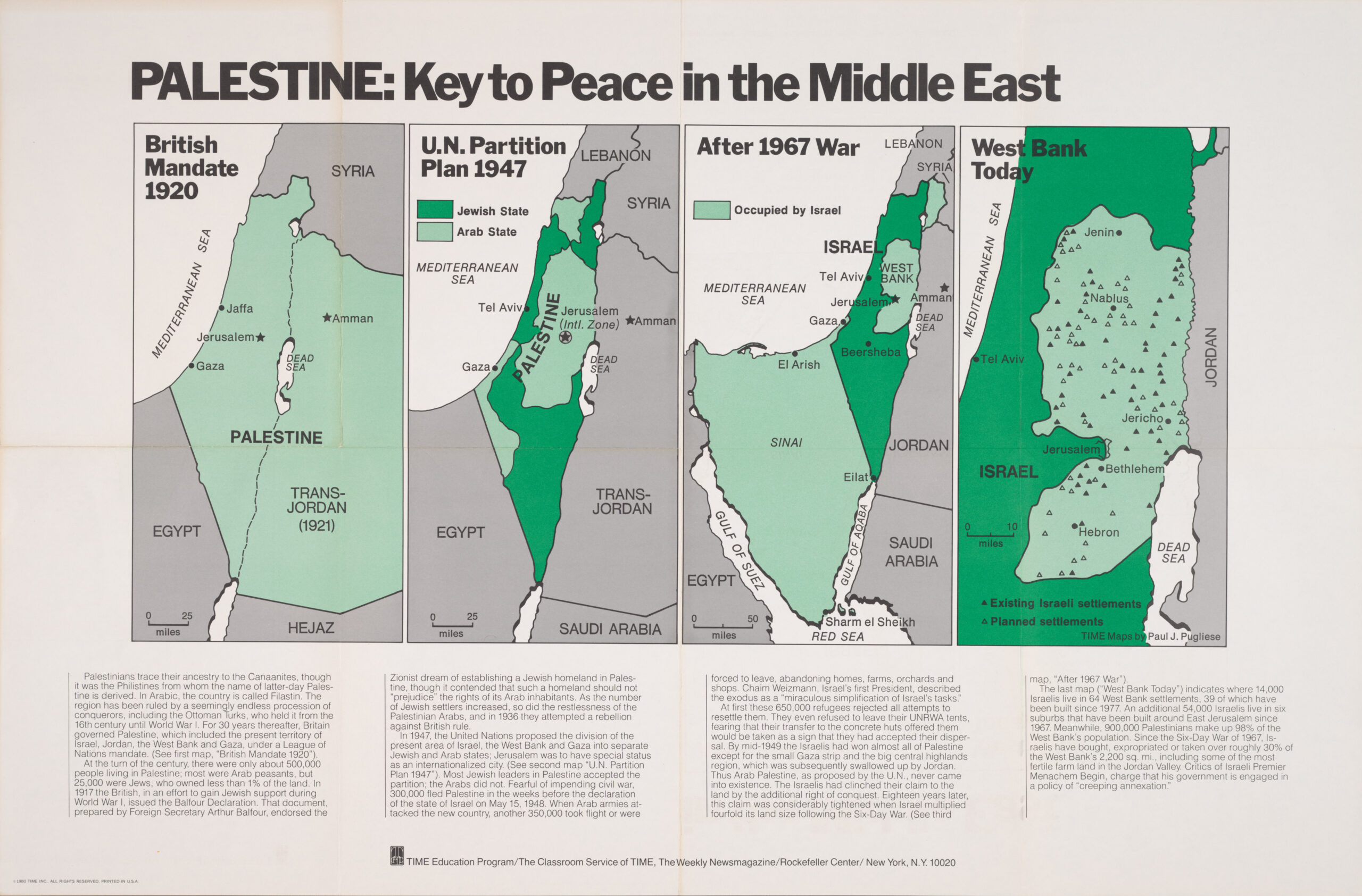
This sequence of maps was created by Paul J. Pugliese for Time magazine's teacher education programme. It details the evolution of the territory occupied by Israel and Palestine from the British Empire's occupation in 1920 to 1980.
- British Mandate of Palestine (1920): This first map shows the territory of Palestine occupied by the British Empire since the partition of the Ottoman Empire through the Sykes-Picot agreements. The Emirate of Transjordan, now Jordan, split off in 1922.
- United Nations Plan for the Partition of Palestine (1947): Plan for partitioning the territory of Palestine to create the state of Israel. On 15 May 1948, the United Kingdom relinquished its mandate over Palestine, leading to the outbreak of the 1948 Arab-Israeli War.
- After the 1967 warAt the end of the war also known as the Six-Day War, Israel occupied all of Palestine, the Sinai Peninsula (on the border with Egypt) and the Golan Heights (on the border with Syria).
- The West Bank today (1980)This last map shows the territory controlled by Palestine in the West Bank in 1980, as well as the 64 settlements in Palestinian territory, which were inhabited by more than 14,000 Israelis.
This series of maps, along with the accompanying text at the bottom, was intended to provide American teachers with perspective on the conflict between Israel and Palestine, providing historical data that explained how the current situation (in 1980) had come about.
Sources

