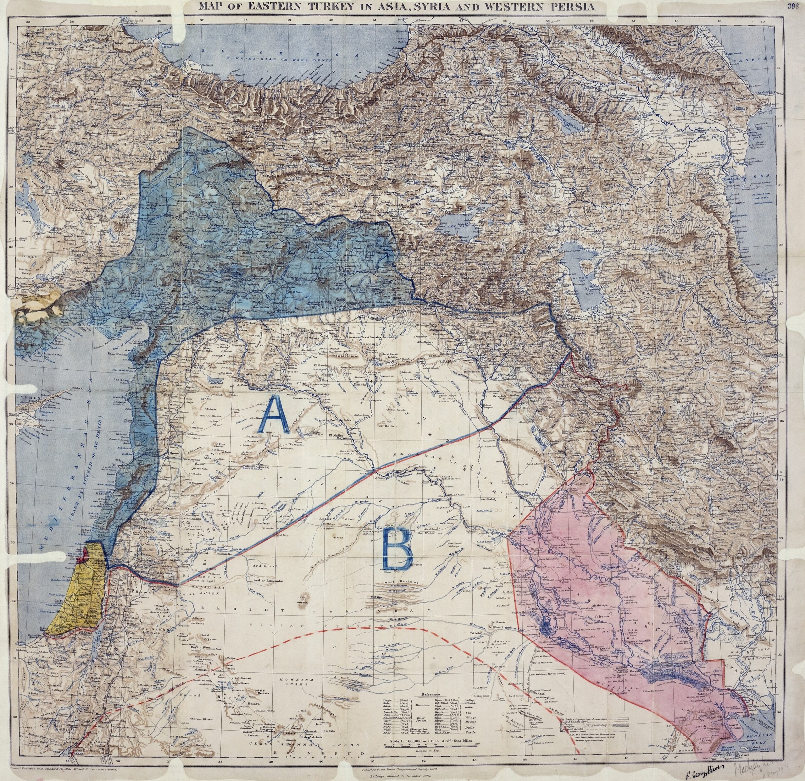
This map, owned by the Royal Geographical Society It was used to sign the agreement whereby the British Empire and France divided up their spheres of influence in Mesopotamia in the event that the Ottoman Empire was defeated at the end of the First World War (which it was). The agreement was signed by Mark Sykes and François Georges-Picot on 8 May 1916, as can be seen in the lower right-hand corner of the map.
This separation marked the birth of a border that currently divides Iraq (marked with the letter B on the map) and Syria (marked with the letter A). This division of spheres of influence also led to a broken promise to the Arabs (allies in the fight against the Ottoman Empire), denying them the formation of a nation in Greater Syria.
With this agreement, the established border was drawn in a completely arbitrary manner, without respecting the connections and cohesions that already existed in the region. It divided the Kurdish population, severed the historical ties between the cities of Mosul and Aleppo, and forced the union of Damascus and Aleppo (and the Alawite area of Latakia).
Sources

