
This map was drawn by illustrator Pierre Lissac for La Vie Parisienne magazine. La Vie Parisienne was a...
Maps from 1920
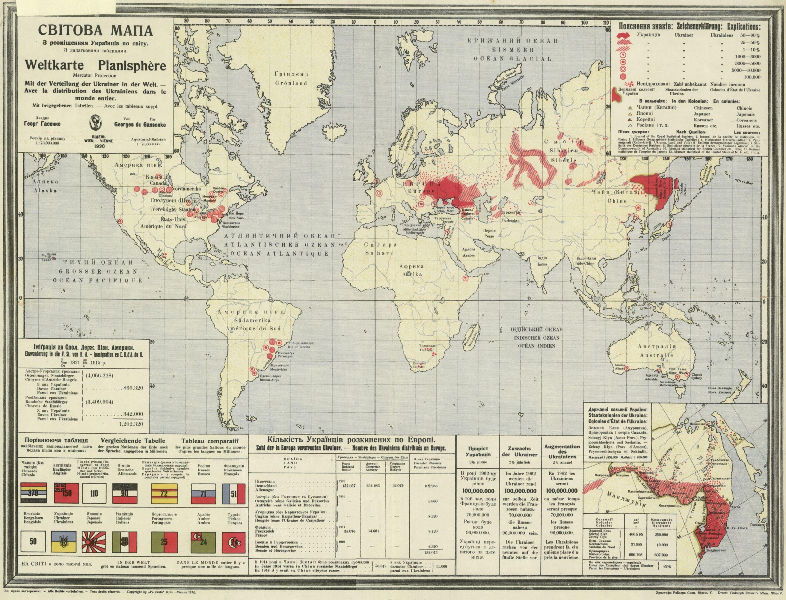
The Ukrainian diaspora (1920)
This map, created by Georg Hasenko and published in Vienna in 1920, shows the distribution of Ukrainians around the world.…
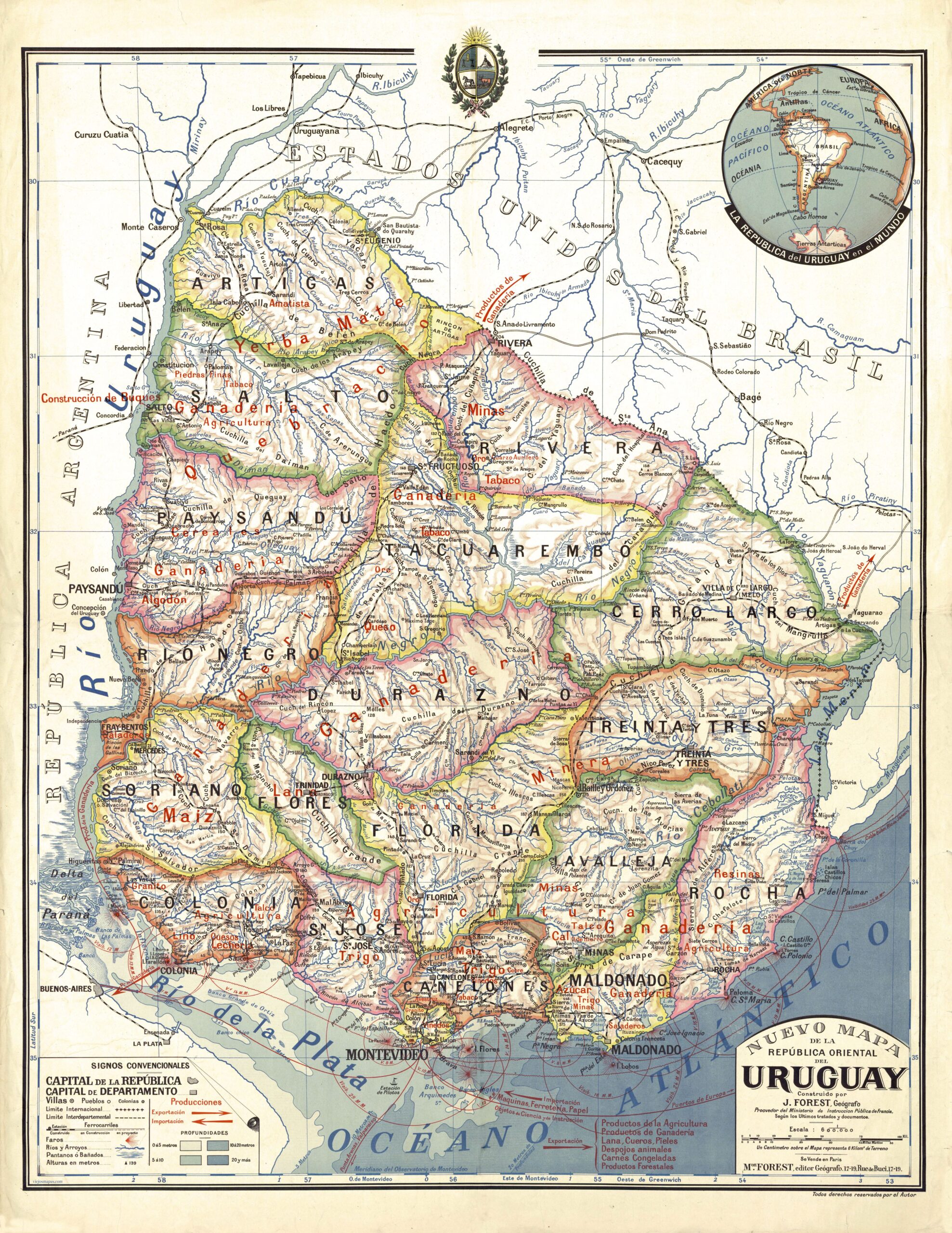
Map of the Eastern Republic of Uruguay (1920)
This map was originally created by French cartographer Joseph Forest for the French Ministry of Education. Given its...
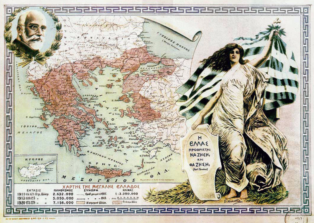
The Great Idea, Greek irredentism (1920)
This map, published by Gr. Kouriotis in 1920, shows Greek irredentist claims in the context of the war...

Map of the Bamun Kingdom (1920)
Between 1912 and 1920, a topographical survey of the Bamun Kingdom was carried out by Ibrahim Njoya, Sultan...
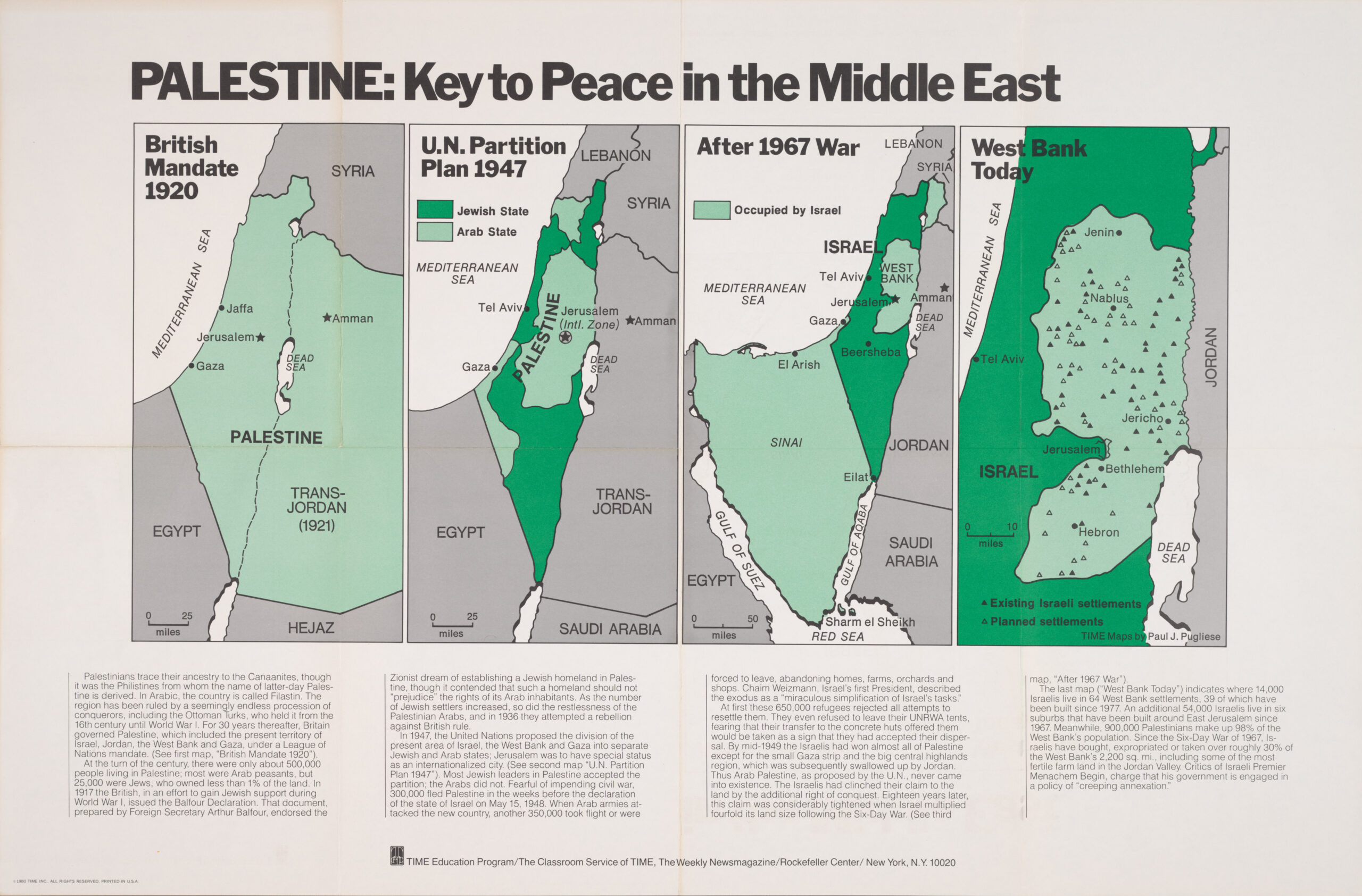
Palestine, the key to peace in the Middle East (1920–1980)
This sequence of maps was created by Paul J. Pugliese for the teacher education programme of the magazine...
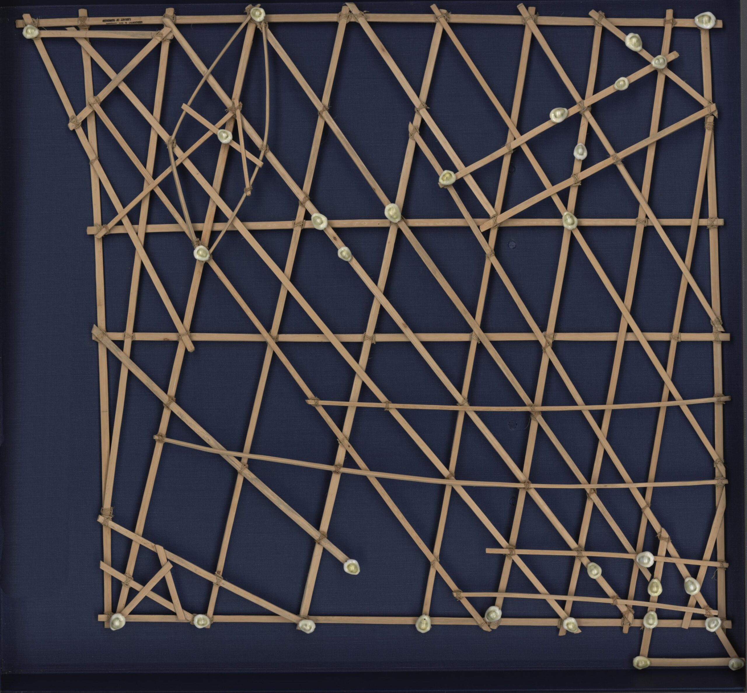
Polynesian navigation chart (1920)
This is one of the typical navigation charts used in the Marshall Islands until the mid-20th century...
 Español
  English (UK)