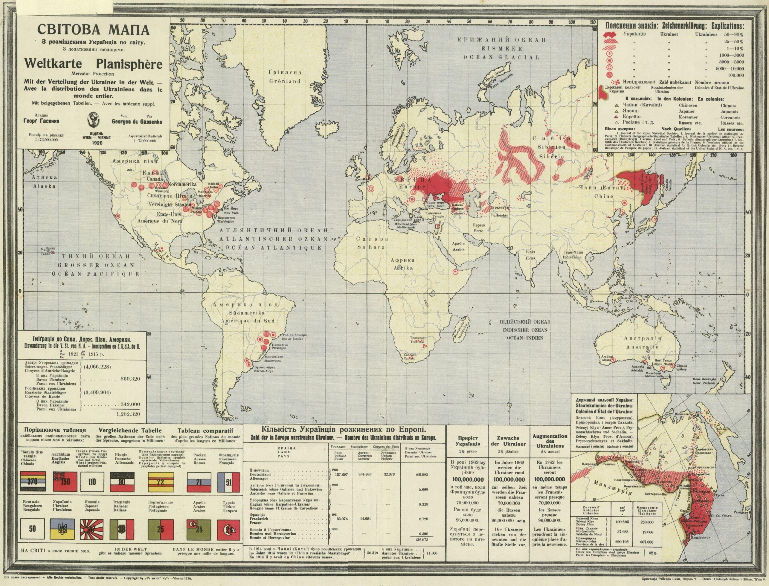
This map, created by Georg Hasenko and published in Vienna in 1920, shows the distribution of Ukrainians around the world.
With this propagandistic work, Hasenko sought to support Ukraine's international importance in the world and legitimise the existence of the newly created Ukrainian People's Republic. This state was born after the October Revolution in 1917 and remained in existence until 1922, although in its final year the government was in exile.
The map shows all regions of the world with Ukrainian populations in red. Regions where Ukrainians made up more than 50% of the population are marked in solid red, including the region of present-day Ukraine, known as Ukraine Raspberry, north of the Caucasus; and the Green Ukraine, in Western Asia. Around Vladivostok, on Russia's Pacific coast, the Ukrainian population exceeded 90% in 1920.
In the lower left corner, the illustration includes a list of the world's major nations, based on the number of native speakers. The author ranks Ukraine ninth with 48 million inhabitants, ahead of established nations such as Italy and Japan.
The map legend is written in Polish, German, and French, in order to increase its reach.
Sources

