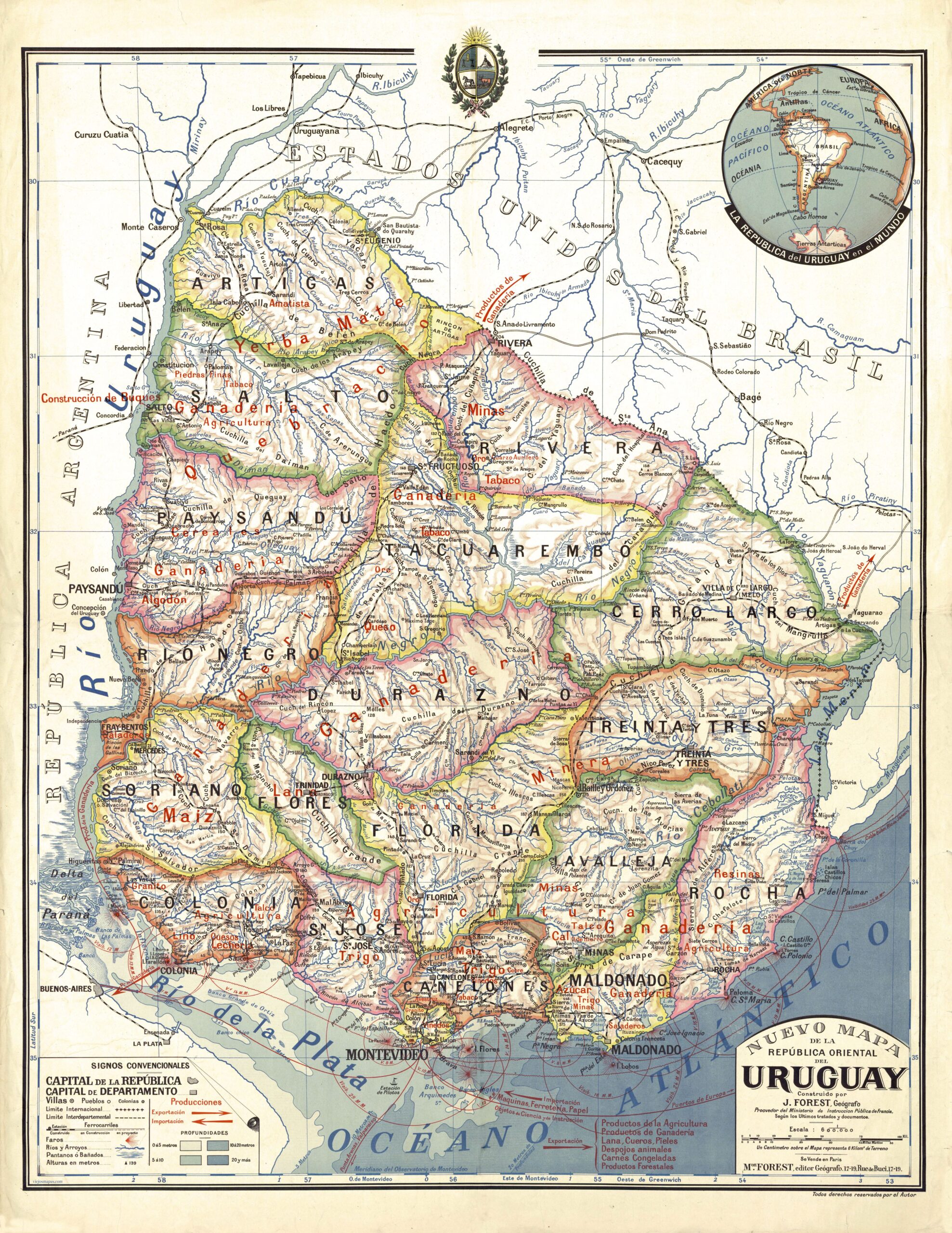
This map was originally created by French cartographer Joseph Forest for the French Ministry of Education. Given its high quality, it was used extensively in Uruguay and other parts of South America.
The map shows the political division of the country, with its 19 departments represented in different colours. In addition, the map highlights the country's production and trade with Europe. To this end, the author writes in red the production of each region of the country, such as agriculture in the south, quebracho and yerba mate in the north, and livestock throughout the country. In the lower right-hand corner, in red, it is highlighted that Uruguay imports machinery, hardware and paper from Europe and, in turn, exports mainly agricultural and livestock products.
Sources

