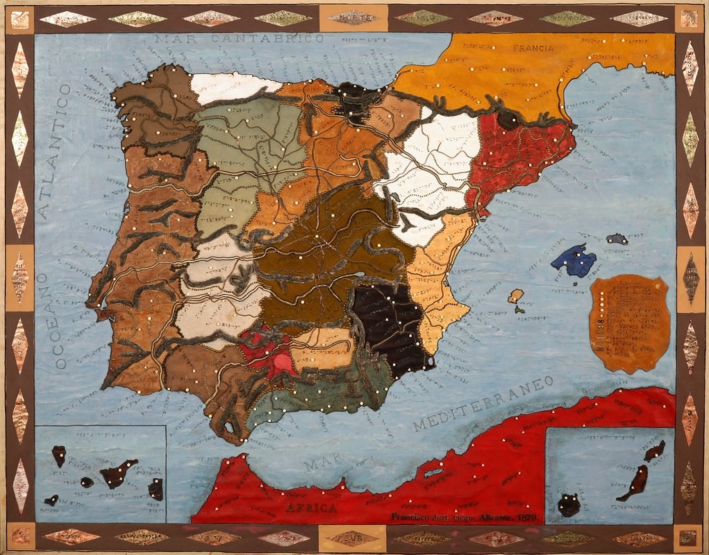
This map, created by Francisco Just y Valentí in 1879, depicts Spain, Andorra, and Portugal, as well as parts of France and North Africa. The map is designed to be interpreted by blind people.
Francisco Just y Valentí lost his sight in 1869, when he was just 27 years old. From that moment on, he devoted his life to teaching the blind at the National College for the Deaf and Blind in Madrid. Drawing on his past experience as a printer, he constructed this relief map for use in his classes.
The map is made on a wooden board measuring 1.95 metres by 1.70 metres. On top of this, fabrics of different materials, such as cloth, leather and cardboard, are superimposed to differentiate the different regions of Spain and neighbouring countries. National, regional and provincial borders are differentiated using tacks of different sizes. In addition, the author uses other materials to show the course of the most important rivers and mountain ranges. Finally, the names of all the places represented on the map are written in Braille.
In the newsletter, I have written more about maps for the blind and their history. You can read it here:
- The origins of cartography for the blind
- Braille, Kunz and modern cartography for the blind
- The present and future of cartography for the blind
Sources

