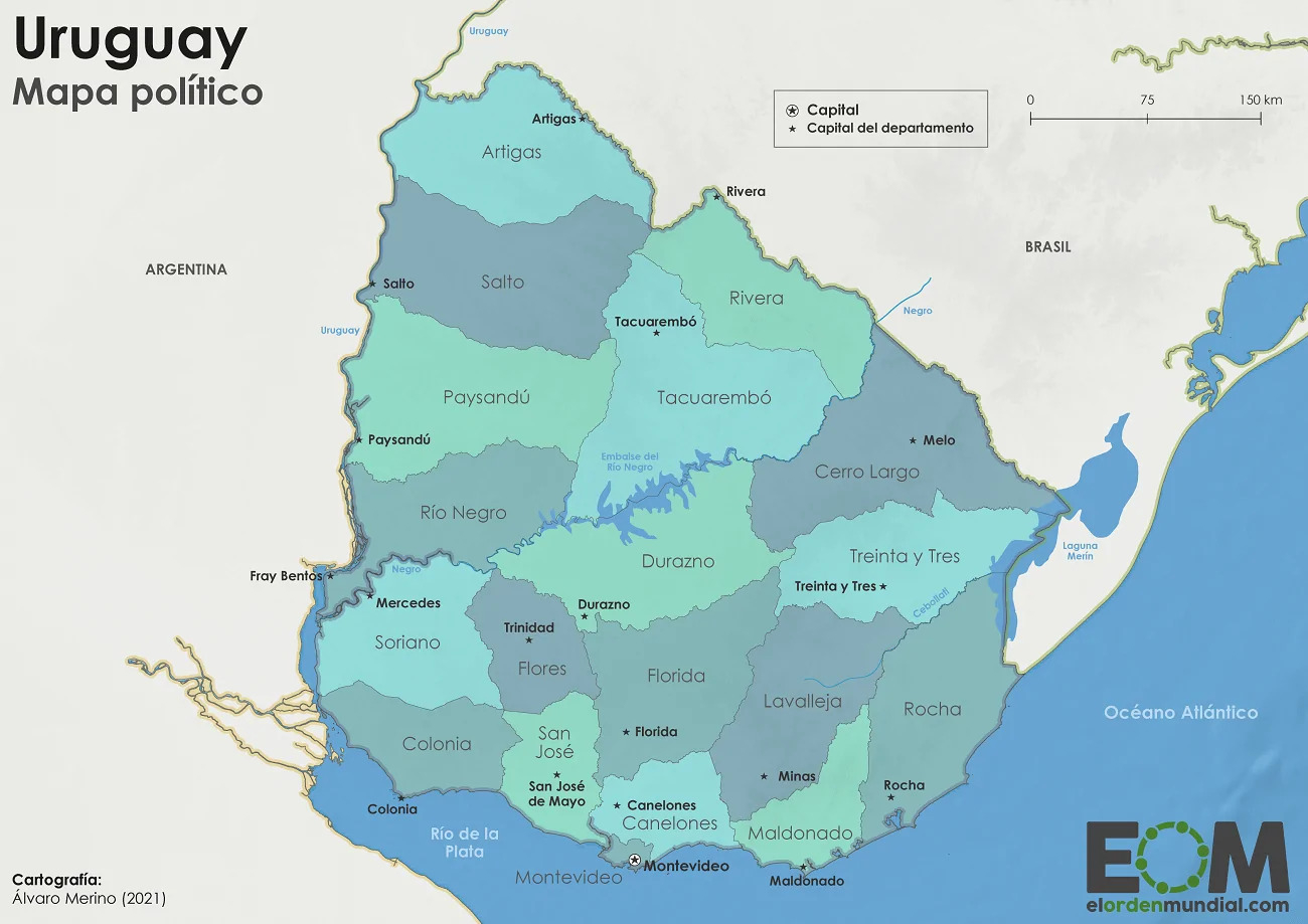
This map, created by Álvaro Merino for El Orden Mundial, shows the territorial division of Uruguay, with a total of 19 departments, each with its respective capital.
In the central part, you can see the Negro River and its chain of reservoirs, which divides the country from east to west, until it flows into the Uruguay River.
Sources

