
This map is one of the most popular maps used on the Internet throughout the 21st century...
Maps of Israel (11 maps)

Greater Israel, according to Revisionist Zionism (1946)
This map was created by the New Zionist Organisation, led by Zeev Jabotinsky. The map was part of a pamphlet...

Growth Against the Siege (1955)
This map was designed by Moi Ver and published in 1955 by the Land Workers' Party...

Jewish imperial aspirations in the Middle East (1967)
This map, drawn by Issa Nakhleh, is part of a pamphlet published in August 1967 by the High Committee...
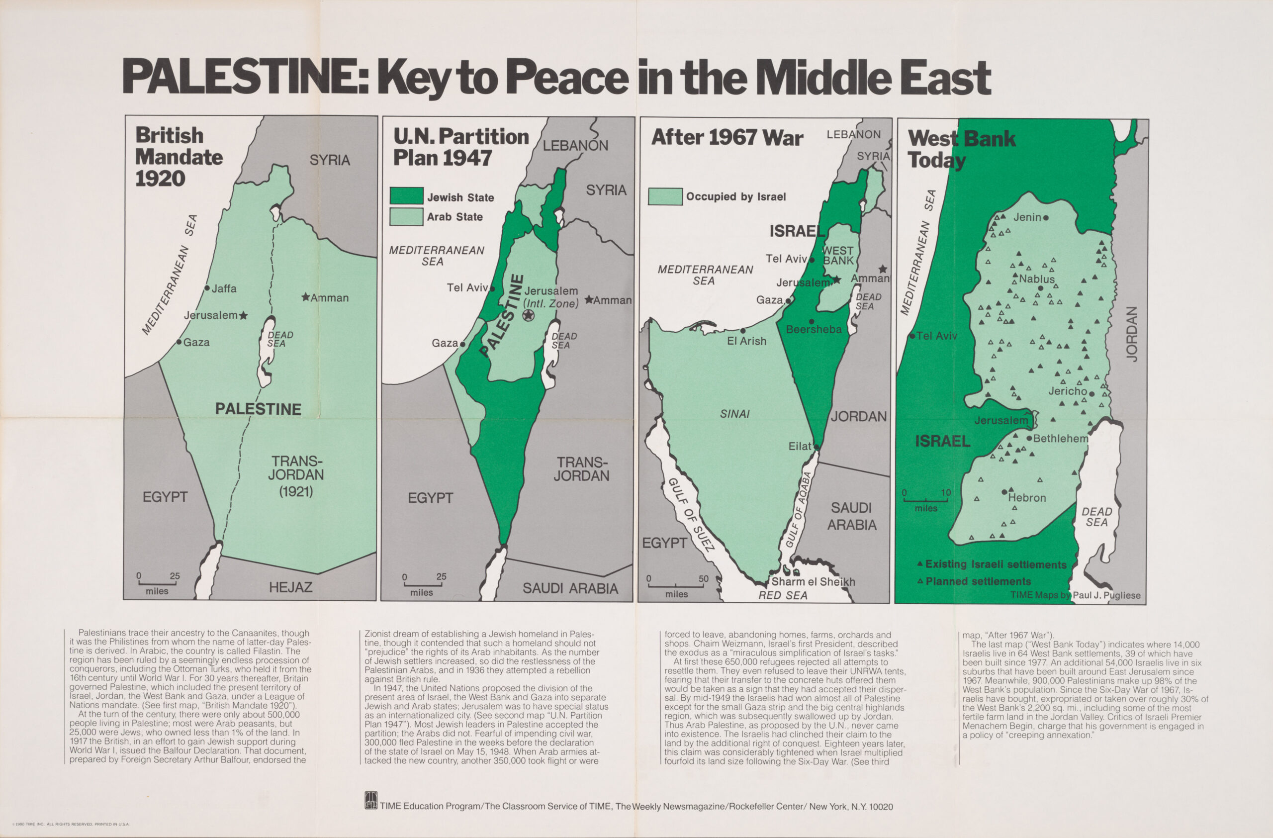
Palestine, the key to peace in the Middle East (1920–1980)
This sequence of maps was created by Paul J. Pugliese for the teacher education programme of the magazine...

Political violence in the Middle East (2018–2024)
This map, published by José Luengo-Cabrera, shows the incidents of political violence reported in the Middle East between 2018 and 2024...
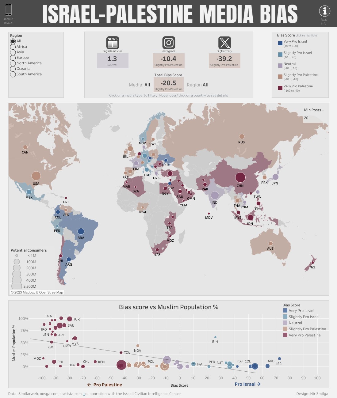
Israel-Palestine, media bias (2023)
This map, created by Nir Smilga in collaboration with the Israeli Civil Intelligence Centre, shows the biases of...

Land Ownership in the Mandate of Palestine (1945)
This map, created by Reddit user Shahanshah26 in 2020, shows the ownership situation of...

The first two-state proposal for Israel and Palestine (1937)
This map of the Middle East was one of the controversial maps published by the Pro-Palestine Herald in autumn 1937.…
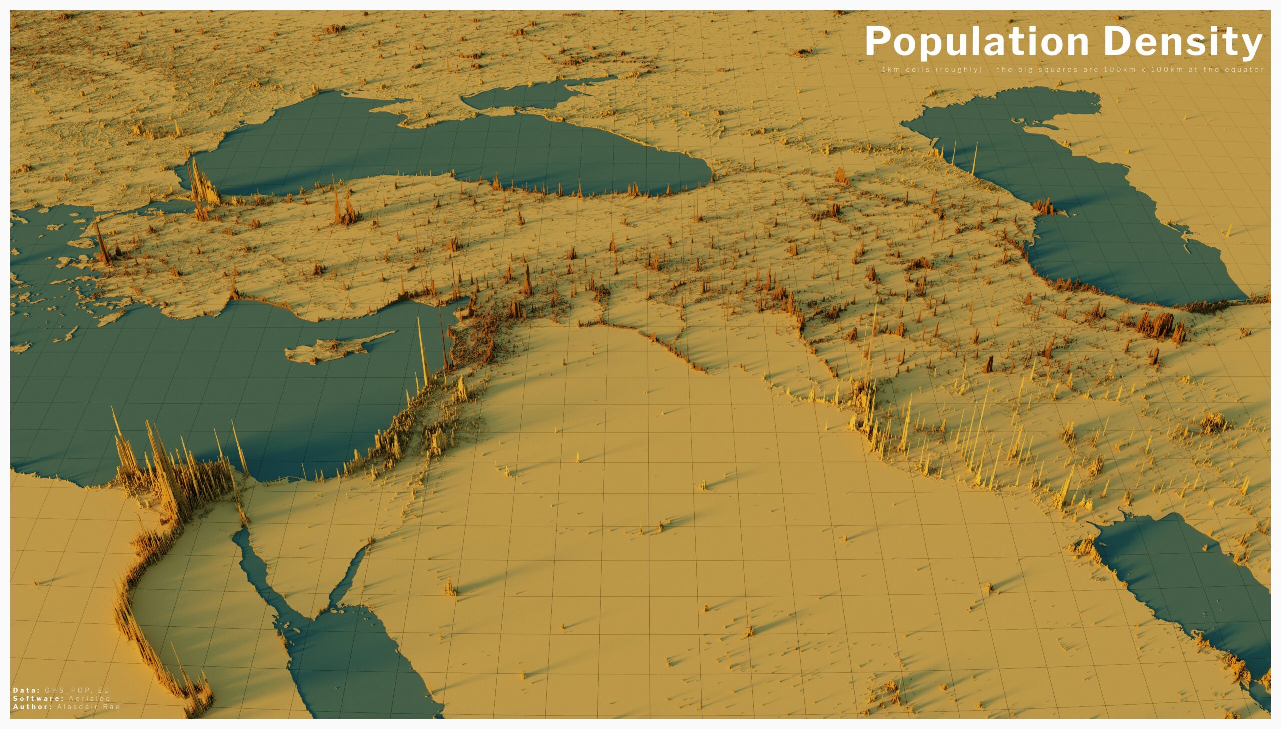
Population density in the Middle East (2020)
The author of this map is Alasdair Rae, founder of Automatic Knowledge, a website for creation and learning...
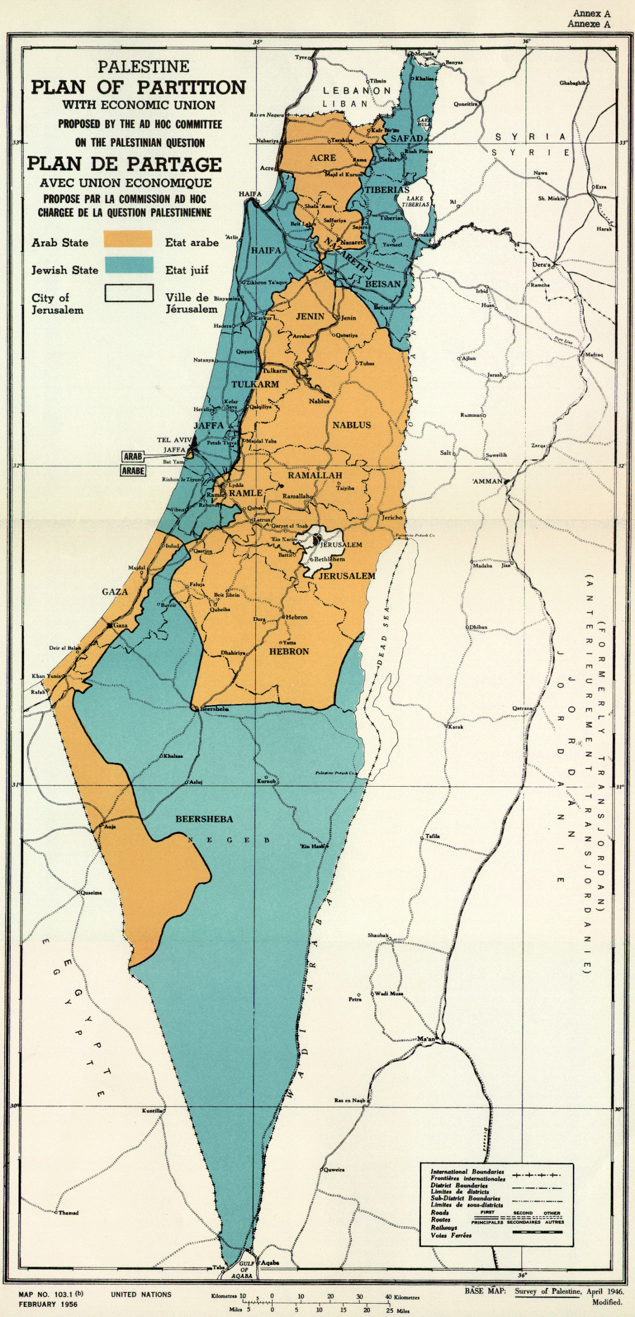
Partition Plan for Palestine (1947)
This map was originally published by the United Nations (UN) in 1947 as an annex to the resolution...
 Español
 English (UK)