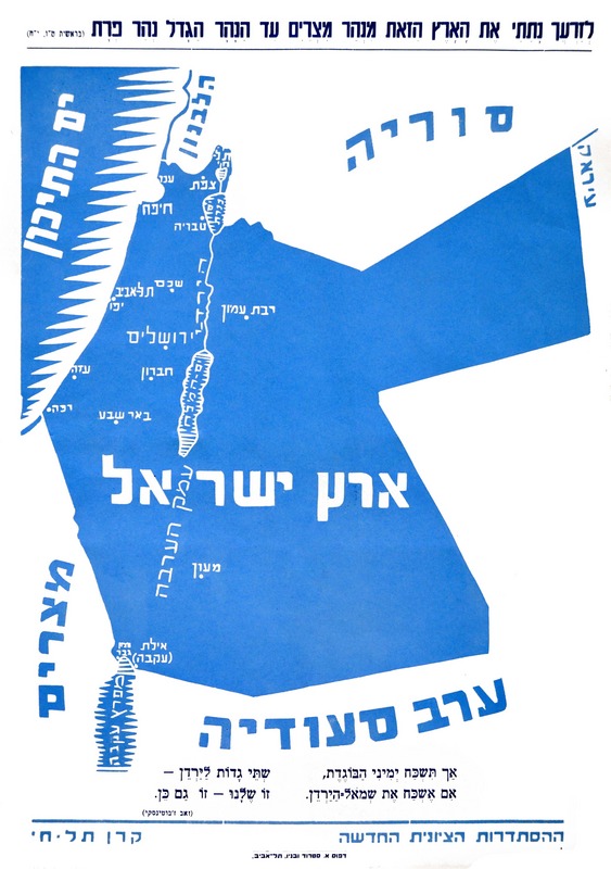
This map was created by the New Zionist Organisation, led by Zeev Jabotinsky. The map was part of a pamphlet that was printed and distributed on the streets of Tel Aviv.
The map, heavily laden with propaganda, shows the vision of revisionist Zionism, which sought to influence the British Empire and other Western powers so that the creation of the state of Israel would extend from the Mediterranean to the Euphrates, covering both banks of the Jordan River.
The illustration, in Hebrew, is headed by a verse from Genesis that can be literally translated as «I have given this land to your descendants, from the river of Egypt to the great river, the river Euphrates.«The rest of the map shows the surrounding countries (Lebanon and Syria to the north, Egypt and Saudi Arabia to the south), as well as the main cities of the proposed Land of Israel.
The source does not indicate exactly when the pamphlet was published, but given that it is signed by the New Zionist Organisation (1935–1946) and that Lebanon already appears as an independent state, it was most likely between 1943 and 1946.
Sources

 Español
  English (UK)