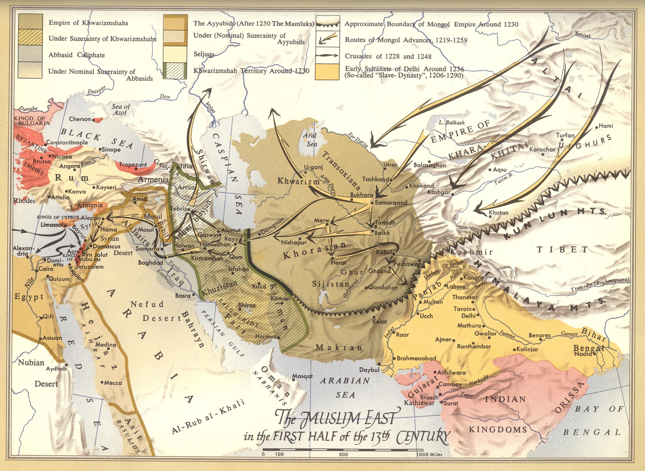
This map by Roelof Roolvink is part of the Historical Atlas of the Muslim Peoples (Historical Atlas of Muslim Peoples), published by Harvard University in 1957.
The map shows the advances of the Mongol Empire between 1219 and 1257 from the plateaus of Central Asia, through Khorasan (in northern Iran) to Iraq and the Mediterranean Levant. During these campaigns, the Mongol Empire completely conquered the Khwarezmian Empire (1231) and the Abbasid Caliphate (1258), two of the main political and military entities in the Middle East during the Middle Ages.
On the map, in the lower left corner, there are also black arrows marking the route taken by the Sixth Crusade (1228), after which Jerusalem was conquered, and the Seventh Crusade (1248–1254).
On this other map you can see the total extent that the Mongol Empire reached.
Sources

