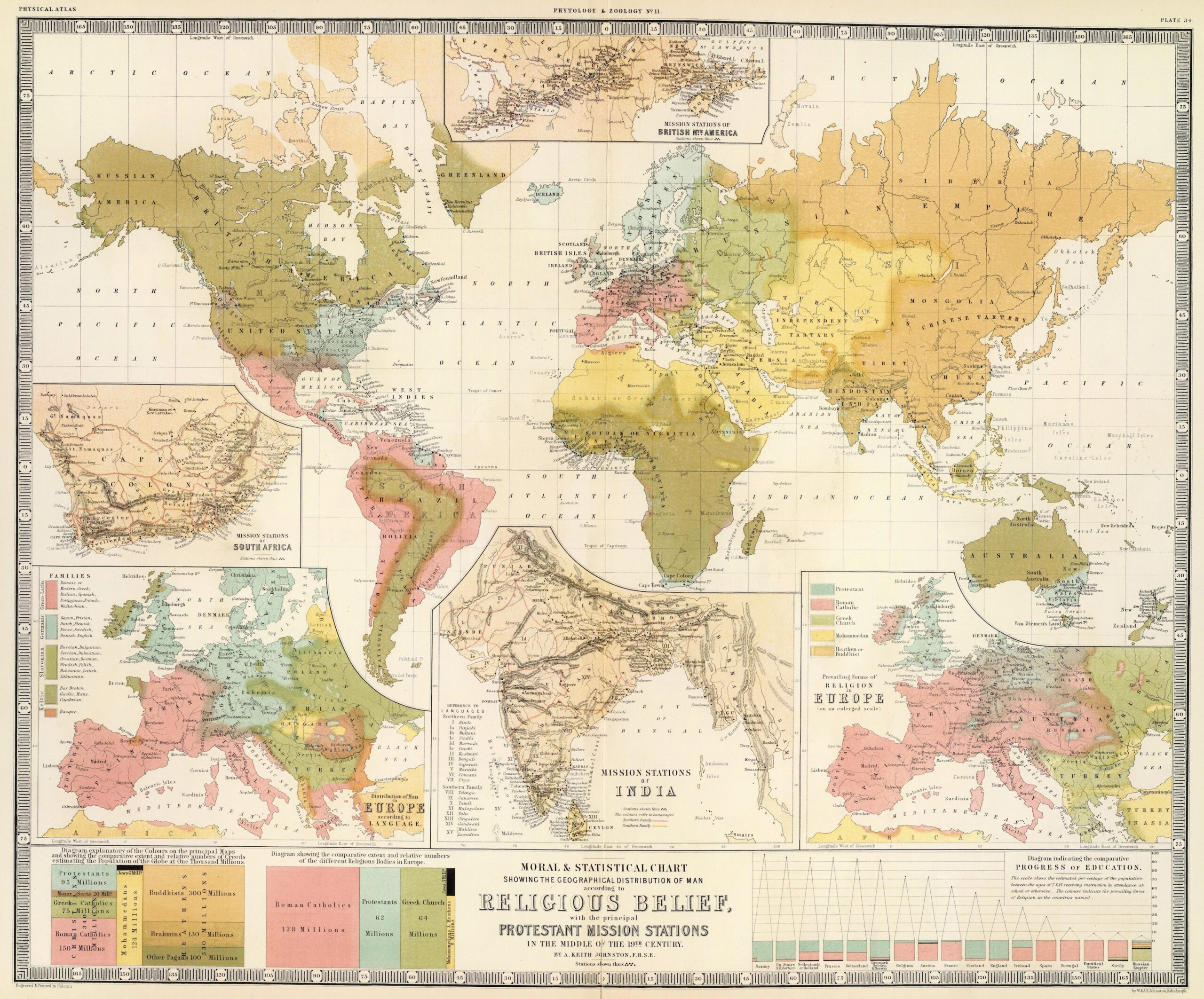
This map, created by Alexander Keith Johnston, appears in the book The Physical Atlas of Natural Phenomena, published in 1856 by William Blackwood and Sons. The map shows the situation of different religions and their prevalence in each part of the world in the mid-19th century.
The main map and the detail of Europe in the lower right-hand corner show the different religions with the following colour codes:
- Rosa: Catholic Church
- Blue: Protestant Churches
- Light green: Orthodox Churches
- Yellow: Islam
- Orange: Buddhism
- Ochre: Brahmanism
- Dark green: Other pagan religions.
This map was published in a context in which the Christian churches (Catholic, Orthodox and Protestant) still had a strong interest in evangelising peoples who did not yet profess some of the great religions. This map, published in the British Empire, shows some of the British evangelistic missions in areas under their control:
- At the top, you can see a detail of the missions that existed in North America.
- On the left-hand side, all existing missions in southern Africa are displayed.
- The missions established on the Indian subcontinent are described below.
The bottom left-hand corner shows a detail of Europe with the most widely spoken language families. The illustration is completed by the bottom section, where there is a legend that also includes the relative number of followers of each religion in the world and in Europe.
Sources

