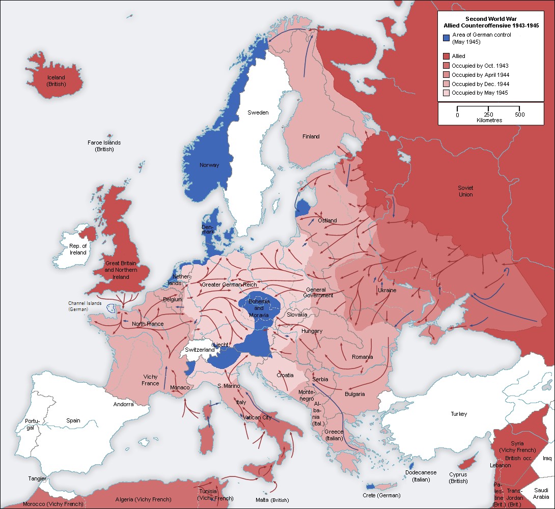
This map was originally created by the Wikimedia Commons user San Jose in German in 2005, and subsequently translated into English by the user Jarry1250.
The map shows the Allied advances in Europe during the counteroffensive between January 1943 and May 1945, when Germany surrendered. The different colours show the Allied advances:
- Darker red: territory controlled by the Allies in January 1943.
- Deep red: territory conquered by the Allies between January 1943 and October 1943.
- Dark pink: territory conquered by the Allies between October 1943 and April 1944.
- Rosa: territory conquered by the Allies between April 1944 and December 1944.
- Light pink: territory conquered by the Allies between December 1944 and May 1945.
- Blue: Territory controlled by Germany at the time of its surrender.
The map also includes red and blue arrows showing the various movements and offensives of armies during this period in Europe.
Sources

