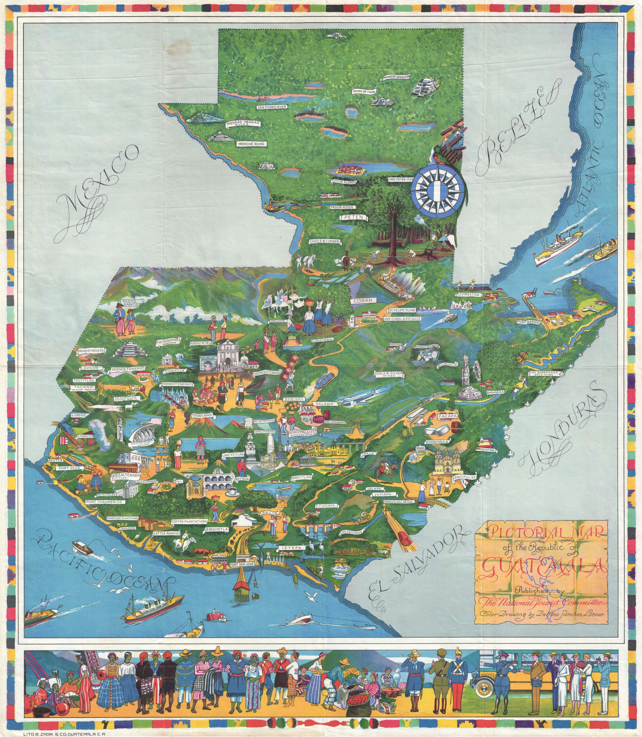
This map, created by Delfino Sánchez Latour, was included in Guatemala: The Land of Enchantment and Colour, a tourist book published in 1936 to promote Guatemala.
The illustration combines various cultural, natural and social motifs to promote the country. Among the many examples, the following stand out:
- The city of Flores, within Lake Petén Itzá.
- The Mayan archaeological sites of Tikal, Zaculeu and Uaxactún.
- The city of Antigua Guatemala.
- Lake Atitlán.
- The town of Esquipulas, with its famous basilica.
- Puerto Barrios, Guatemala's gateway to the Caribbean Sea.
At the bottom, several illustrated individuals are also shown, representing some of the typical costumes of Guatemala at that time, both civilian and military.
If you would like to read more about pictorial maps, I recommend reading this article.
Sources

