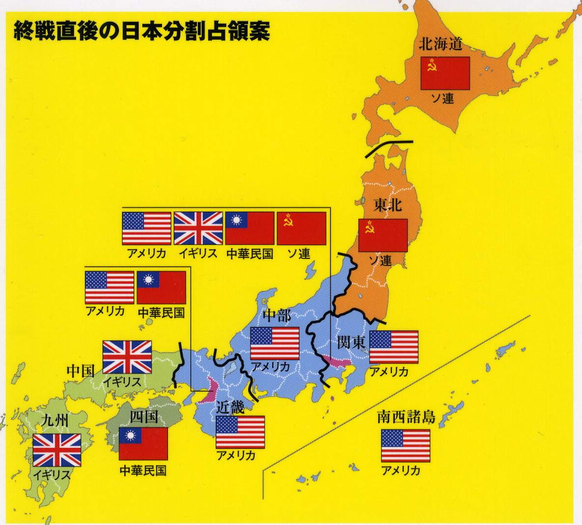
This map represents the proposal that was on the table regarding the possible partition of Japan at the end of the Second World War into territories controlled by different powers, something similar to what did happen in Germany and, in a less planned manner, in Korea.
The proposal maintains the division into six regions:
- Tokyo, with shared control between the United States, the United Kingdom, the Republic of China, and the Soviet Union.
- Osaka, with shared control between the United States and the Republic of China.
- Hokkaidō, the Kuril Islands, and northern Honshū, controlled by the Soviet Union.
- The Ryūkyū Islands and central Honshū, controlled by the United States.
- Shikoku, controlled by the Republic of China.
- Kyūshū and western Honshū, controlled by the United Kingdom.
The proposal was not implemented, and Japan remained under the primary control of the United States during the occupation following the Second World War.
The map is in Japanese, but I haven't been able to locate its source. If you know where it comes from, please feel free to contact me so that I can cite it properly. I obtained this version of the map from the one on the Vivid Maps website.
Sources

