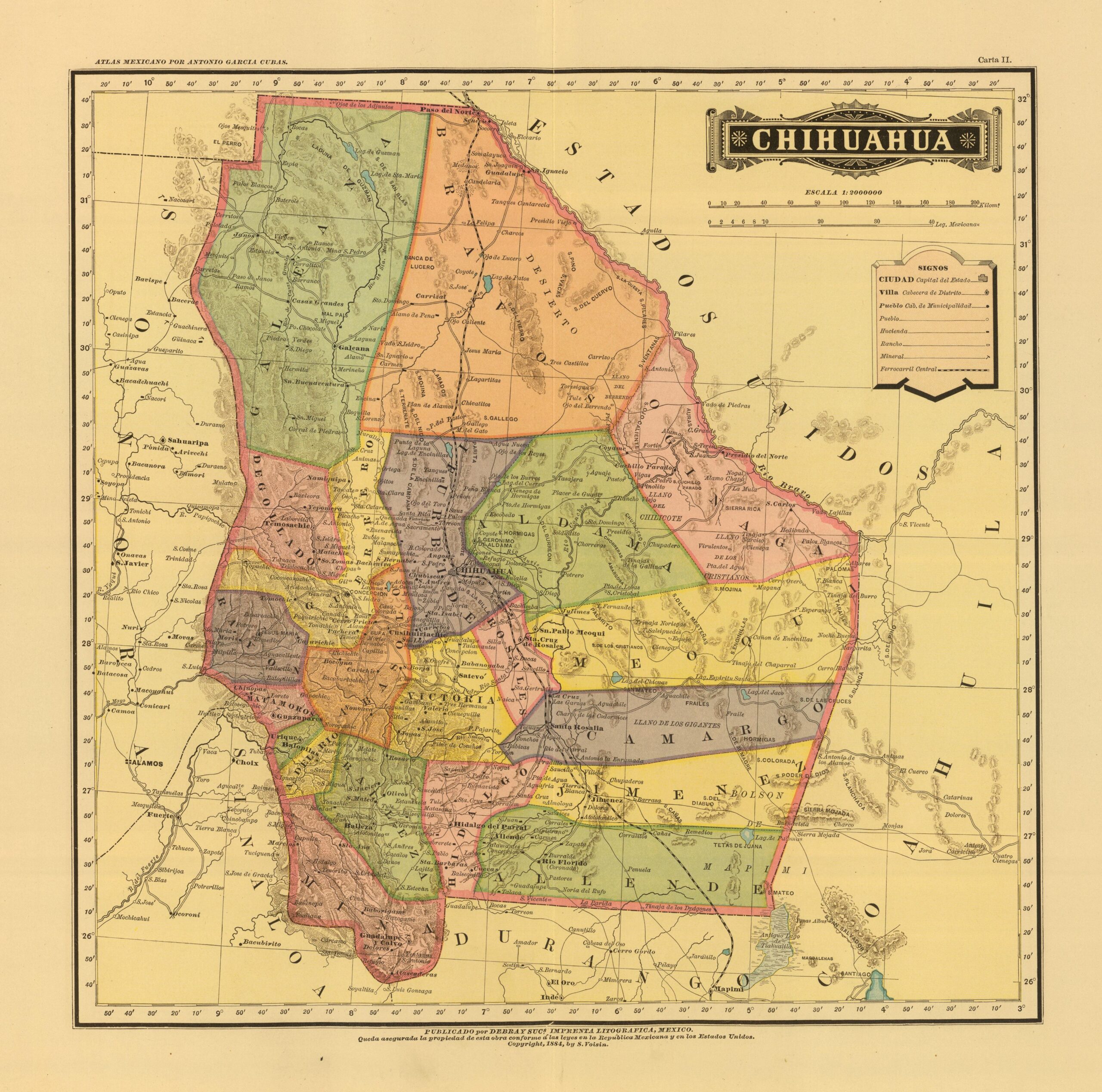
This map, drawn up by the Mexican cartographer Antonio García Cubas, was originally published as part of the Geographical and Statistical Atlas of the United Mexican States in 1858. It is the first atlas of Mexico produced by a Mexican cartographer. This particular edition was published by Debray Sucesores in 1886.
The map depicts the state of Chihuahua, the largest state in Mexico, with its most populated localities, main geographical features and administrative boundaries (in different colours). The state was bordered by the United States to the north, Coahuila to the east, Durango and Sinaloa to the south, and Sonora to the west.
Sources

