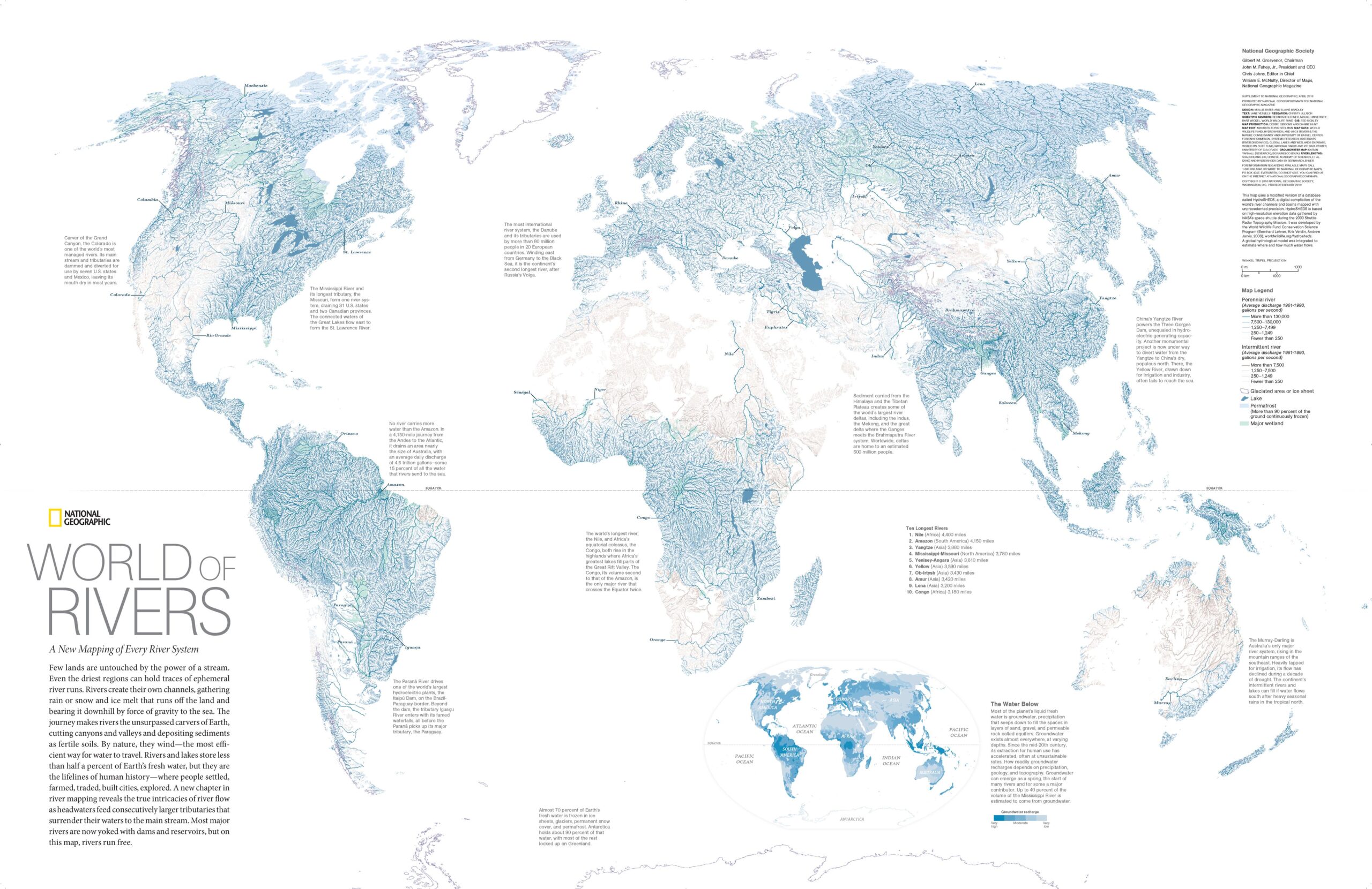
This map, published by National Geographic magazine in 2010, depicts the world's most important freshwater bodies. The illustration was created by an extensive team, including cartographers, scientists, writers, and artists.
Despite bearing the title World of Rivers (World of Rivers), the map depicts different types of freshwater bodies:
- The grey and blue lines show the different rivers on the planet. The intensity of the blue corresponds to the rivers that had the highest average flow between 1961 and 1990.
- The purple lines delimit the extent of existing glaciers.
- In dark blue the different lakes are painted.
- In light blue The entire surface covered by permafrost is painted, only in northern Siberia, Canada and Alaska.
- In light green, The entire surface area of the world's wetlands is painted.
At the bottom is a small world map showing the large groundwater reserves in each region of the world. While glaciers hold 68% of the planet's fresh water, groundwater accounts for 30% of the total, leaving only 2% for lakes, rivers, permafrost and wetlands.
Sources

