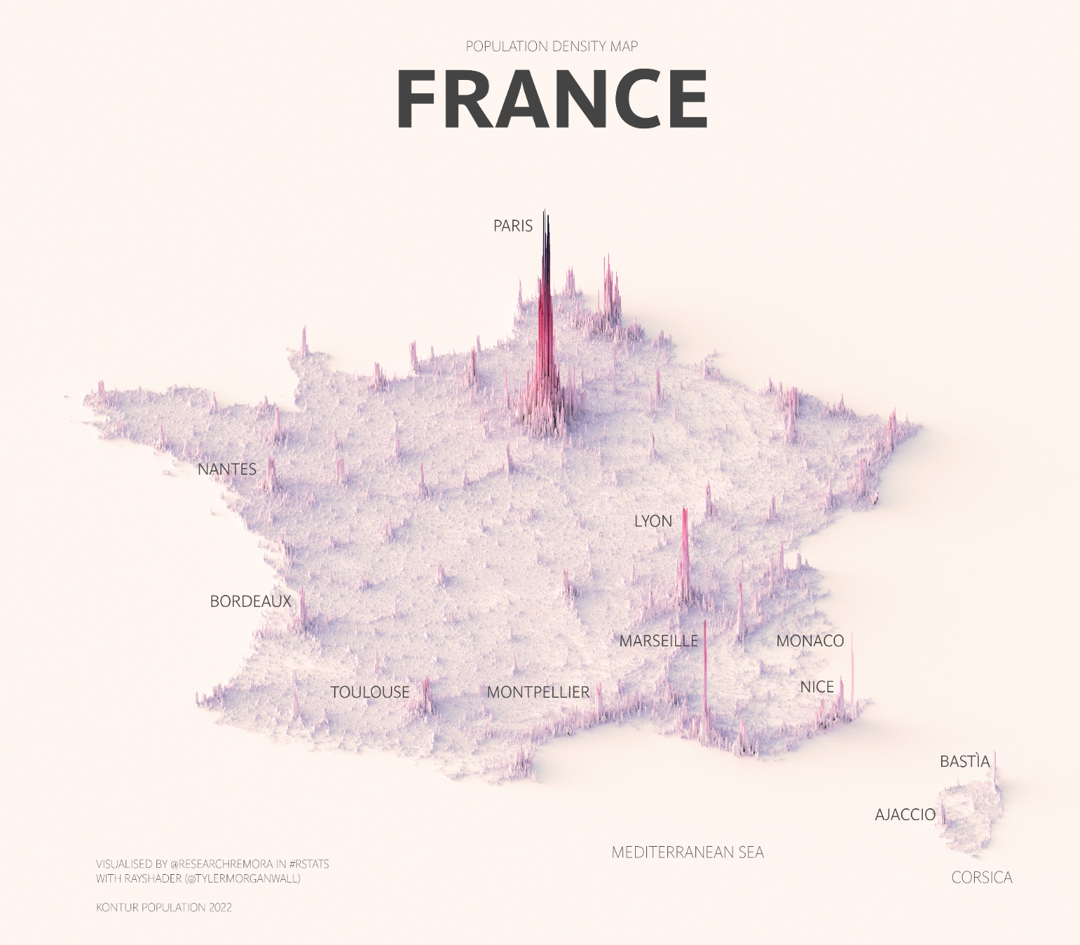
This illustration, created by Terence Teo, represents the population density of France on a three-dimensional map. To do this, Terence extracted the data available at Kontur Population with which it generates columns using a programme, with a height that represents the population density at each point.
This map of France shows, above all, the large population peak in Paris and its metropolitan area. In the background, significant peaks can also be seen in other major cities in the country, such as Lyon, Marseille, Toulouse, Bordeaux and Nice. As in other countries with a Mediterranean coastline, there is a constant accumulation of population along the entire southern coast.
Sources

