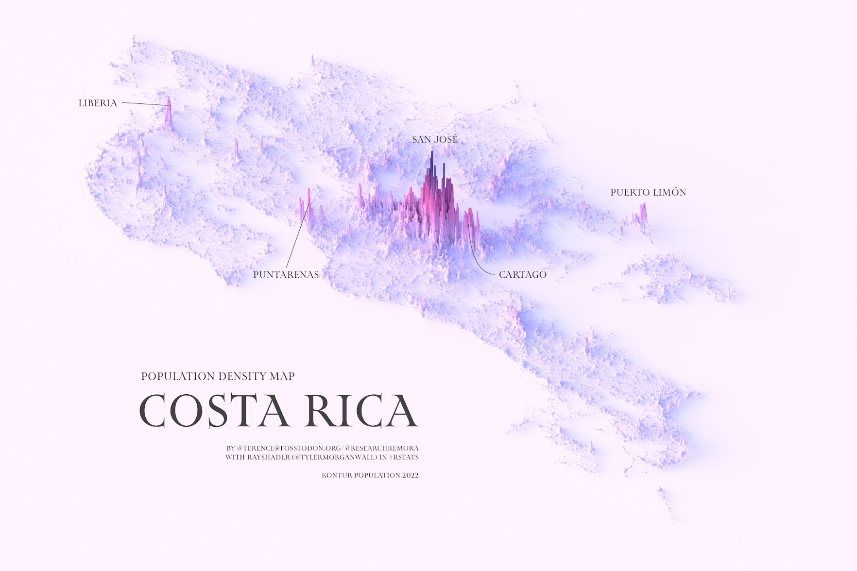
This illustration, created by Terence Teo, represents Costa Rica's population density on a three-dimensional map. To do this, Terence extracted the data available at Kontur Population with which it generates columns using a programme, with a height that represents the population density at each point.
This map of Costa Rica quickly shows that the highest population density is found around the capital, San José. Other large cities outside the capital's metropolitan area, such as Cartago, Puerto Limón, Puntarenas and Liberia, also have higher population densities.
Sources

