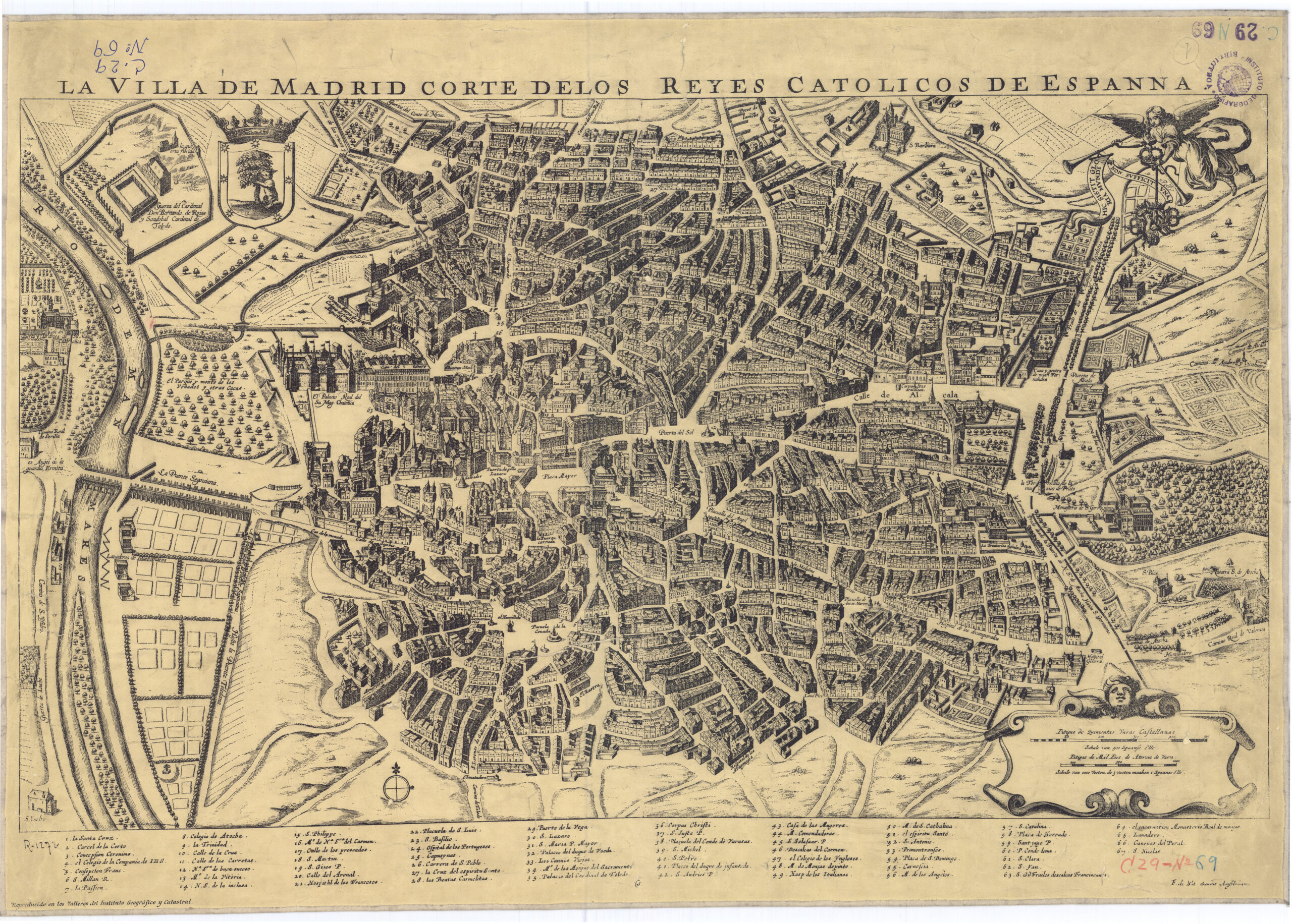
This map, originally titled The City of Madrid Court of the Catholic Monarchs of Spain, It was created by Italian cartographer Antonio Mancelli. Data was collected between 1614 and 1623, resulting in two plates that would form the map we know today, which was published in 1623. It uses a bird's-eye view perspective and is the first known map of the city of Madrid.
Originally, 300 sheets, 150 plans and another 150 prints of this map were printed, none of which are preserved today. This copy, present in the Map library from the National Geographic Institute, corresponds to a copy published by Frederik de Wit around 1695 in the Netherlands.
Sources

