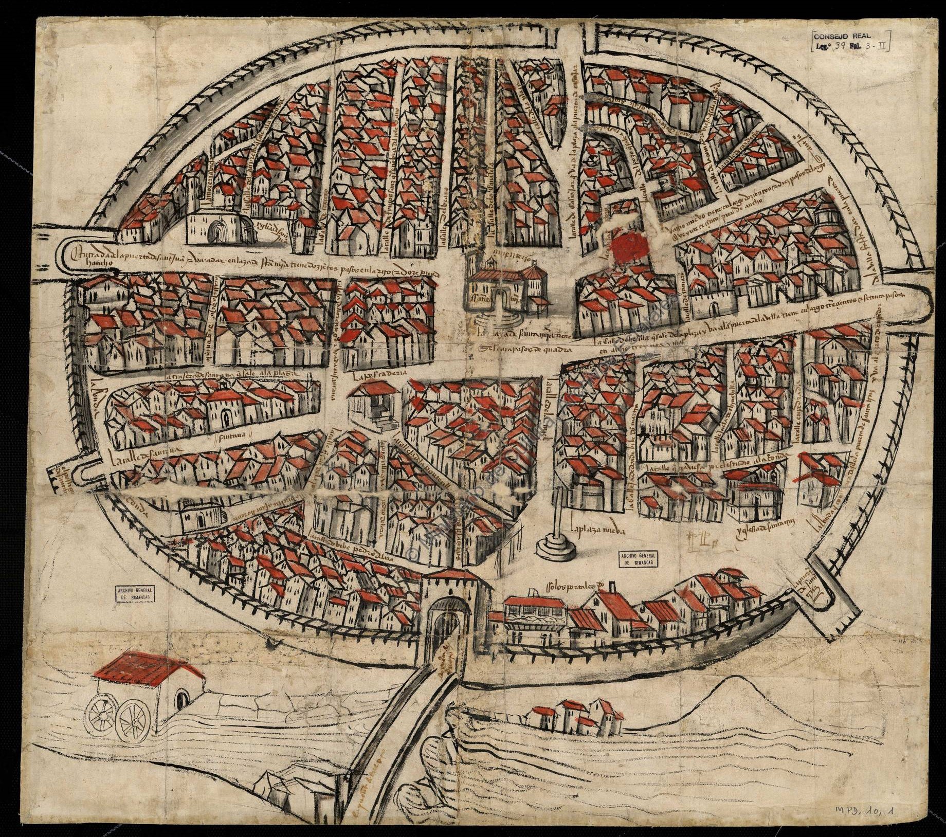
This map of the town of Aranda de Duero was published in 1503 as additional material to resolve a dispute between residents of the town. It is currently preserved in the Simancas Archive.
The conflict is marked by a red dot that can be seen near the centre of the map, towards the upper left-hand side. A group of people were in favour of opening a new street leading to Santa María Square in the centre, while the owners of the houses that would have to be demolished were against it. The council decided to demolish the houses and open the street, with the resulting urban improvement.
But the greatest importance of this map lies in its style. It is the first urban map in the history of Spain to use an almost bird's-eye view. In a way, the author is forced to paint the houses from a bird's-eye perspective, without affecting the layout of the streets, even if this means distorting some of the houses.
In 1503, Aranda de Duero still preserved its entire wall and all its gates, as shown on the map. The map also highlights the great importance of the River Duero, which is the only part of the city outside the walls shown at the bottom. Although not shown on the map, the city had already expanded across the River Duero to the neighbourhood of Allendeduero and to the north, where the suburb of San Francisco was located.
Sources
- Perspective plan of the town of Aranda de Duero
- Map of Aranda de Duero from 1503, the oldest in Spain
- Map of Aranda de Duero from 1503

