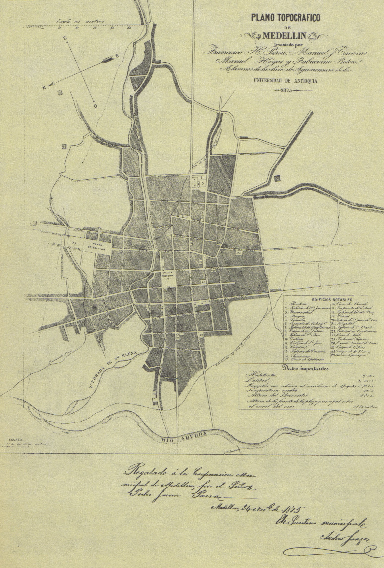
This map of Medellín was drawn by a group of four students from the University of Antioquia in 1875, located in the city of Medellín itself. Its publication was intended to commemorate the 200th anniversary of the town.
The map, with north pointing to the left, shows the Aburrá River flowing through the east, as well as a series of streams or ravines that crossed the town and marked the layout of the streets.
This is the first map to be made publicly available, as until now all maps belonged to private collections that were not accessible to the general public.
Sources

