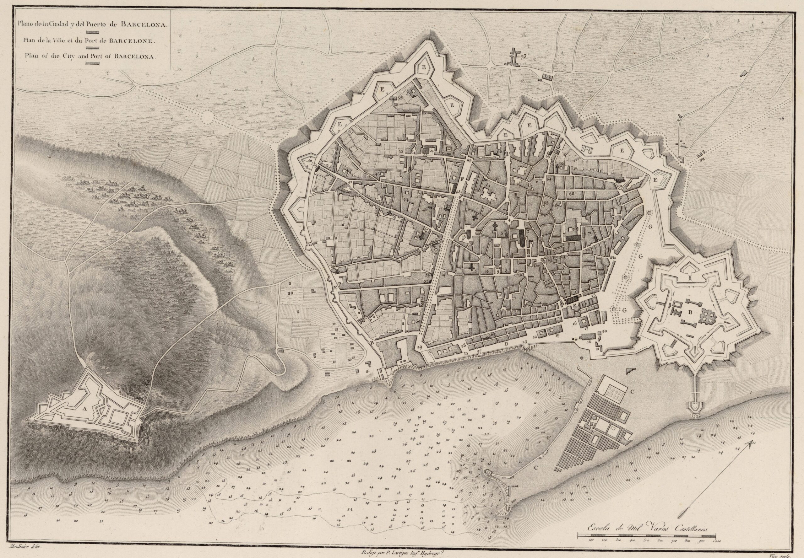
Map of the city and port of Barcelona published by Frenchman Alexandre de Laborde in 1806.
The map shows the extent of the city at the beginning of the 19th century, when the modern walls erected in the 16th century as an extension of the old medieval wall were still standing. The area occupied by Barcelona at that time corresponds to the Old Town district, which includes the working-class neighbourhoods of El Raval, El Gòtic, Sant Pere, Santa Caterina i la Ribera and La Barceloneta (the old port).
On 24 August 1854, the government granted permission for the demolition of the city walls, thereby paving the way for the expansion of the city, one of the most iconic examples of European urban planning.
Sources

