This map was published Perrin Remounted in 2023 as part of the initiative #30DayMapChallenge.
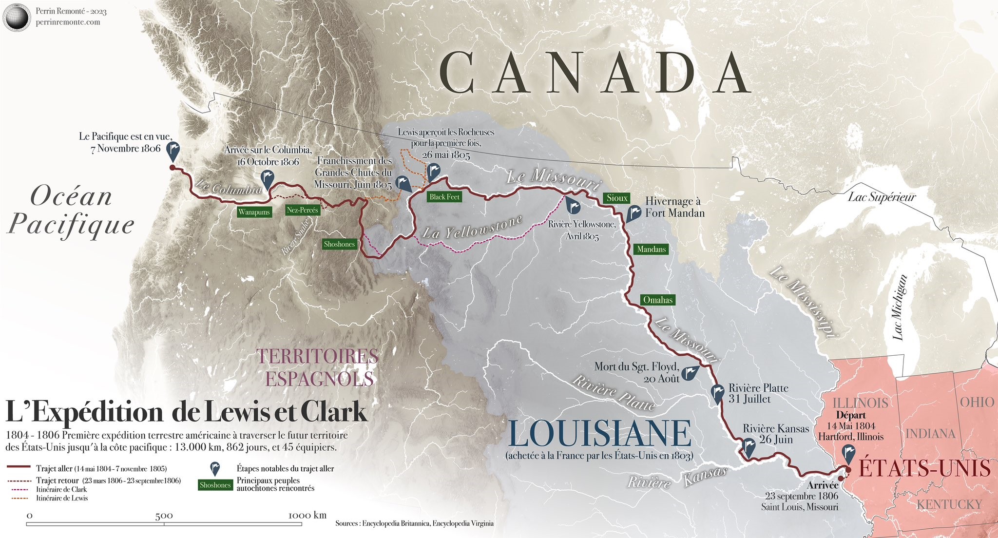
The map details the expedition carried out by Meriwether Lewis and William Clark between 14 May 1804 and 7 November 1805 to travel from the United States to the Pacific coast (the map has a small error in the date of arrival at the Pacific coast). The return journey followed the same route, ending on 23 September 1806.
This expedition was commissioned by US President Thomas Jefferson after the Louisiana Purchase in 1803. Perrin Remonté's map shows the expedition's route, as well as some of its discoveries, marked with blue flags, and some of the tribes with which the Americans first came into contact during this journey, marked in green.
The Lewis and Clark expedition was key to laying the foundations of naturalism in the United States, but also as a first step in the country's expansionist policy throughout the 19th century.
You can find more information about the initiative here. #30DayMapChallenge in what I wrote in the newsletter.
Sources

