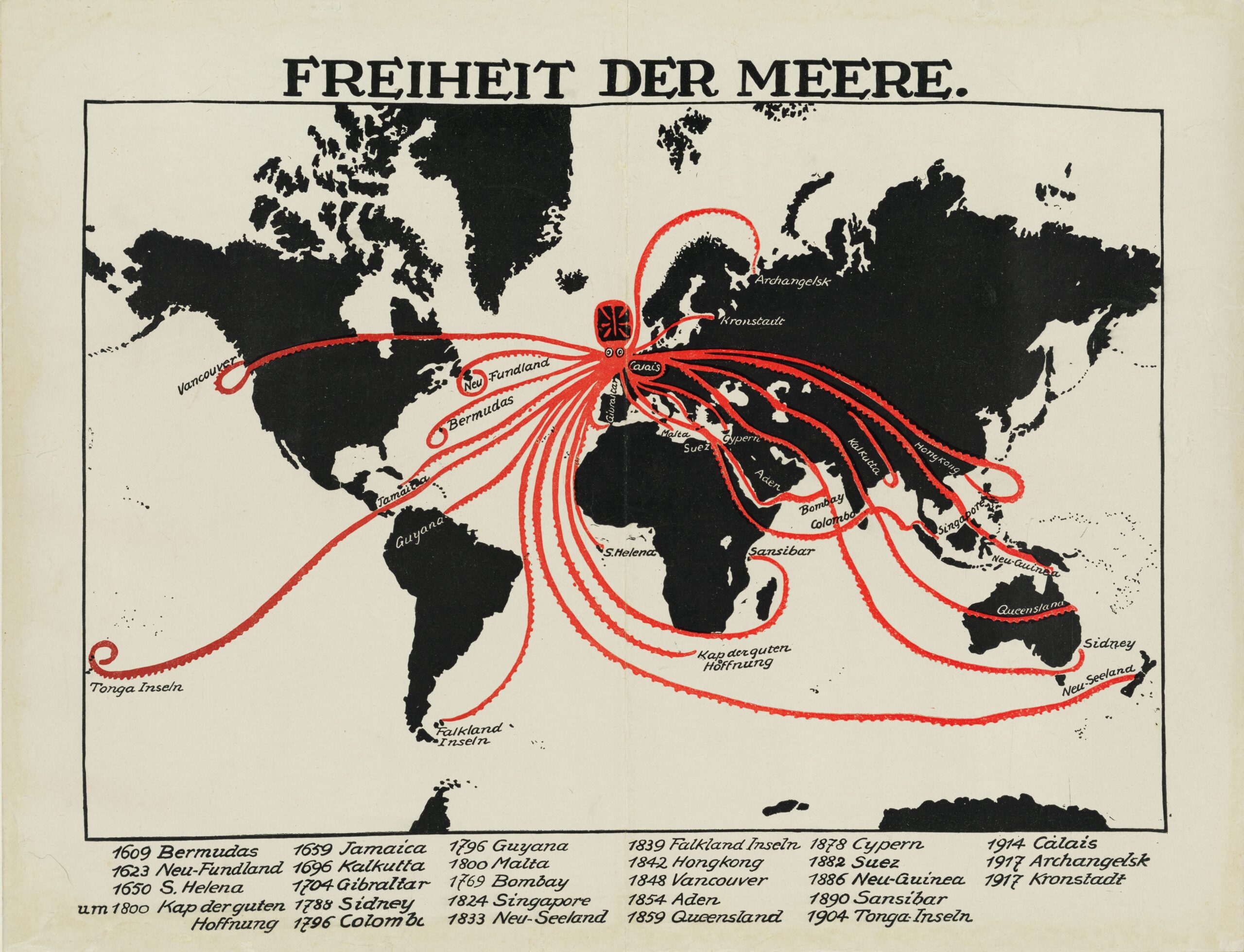
This poster, by an unknown artist, was published in Germany in 1918 during the First World War. It depicts the United Kingdom as an octopus, whose tentacles refer to the colonial expansionism of the British Empire.
The map is heavily laden with propaganda, as it attempts to portray the British Empire as a power that has conquered every corner of the seas over the centuries, thereby depriving other nations of the freedom to sail the oceans.
The tentacles of the map reach the most important ports owned by the British Empire around the world. At the bottom, all these ports are listed with the year in which the British took control of them, from 1609 to 1917. The fact that this map includes control of the port of Arkhangelsk and the island of Kronstadt in Russia highlights the persuasive nature of the map, as the United Kingdom never had real control over these cities, but only maintained an intervention that sought to keep the Russian Empire as a combatant in the war.
This map, like many others that use octopuses, is heavily influenced by the map of Fred W. Rose. In this monograph, You can see many more examples.
Sources

