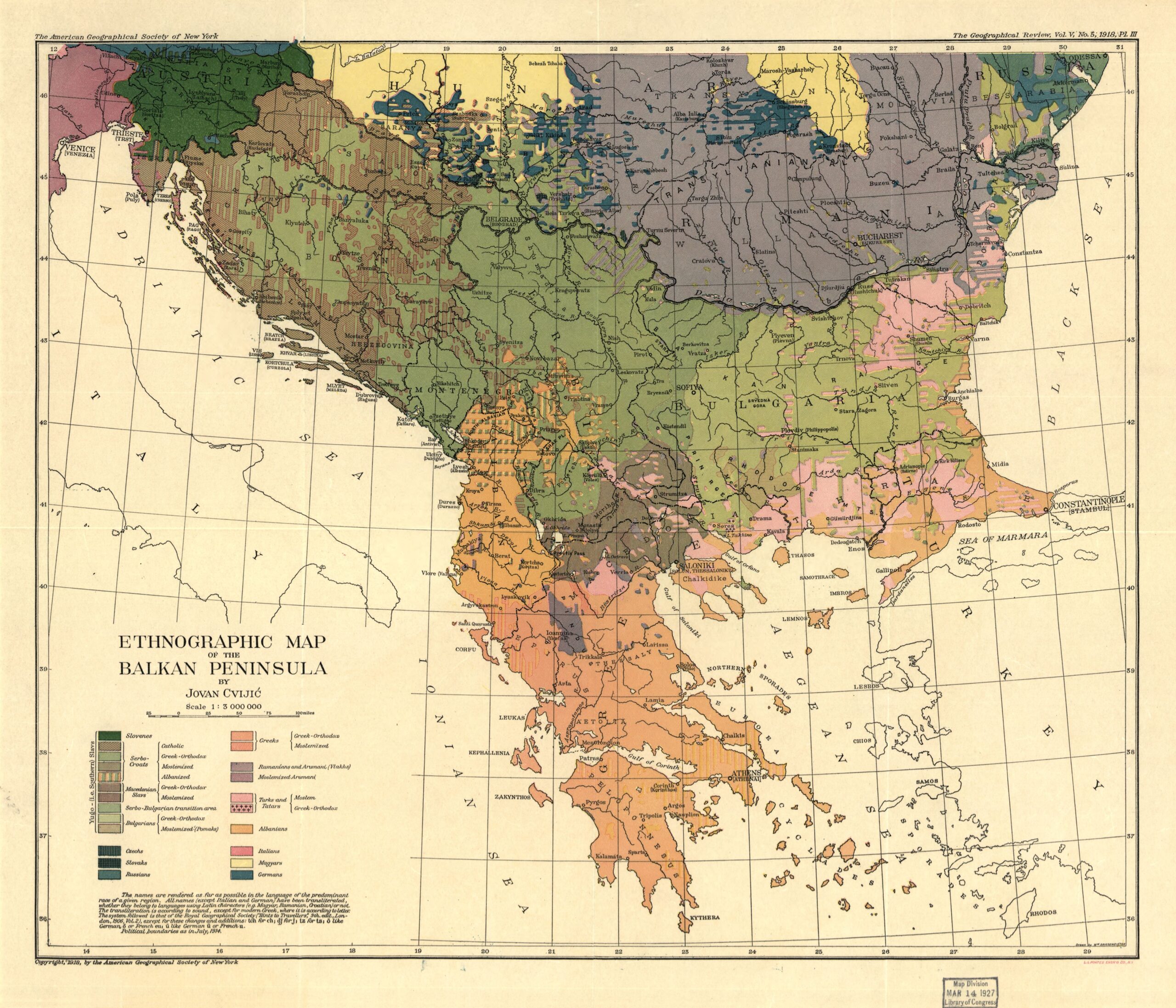
This map was created by Jovan Cvijić, a Serbian geographer, ethnologist, and historian. It was published in 1918 by the American Geographical Society in New York.
The author shows the complex ethnic reality of the Balkans during the First World War, the period covered by this map, with borders as they were in 1914. The different colours represent the predominant ethnic groups in each region, including:
- Dark orange: Greeks.
- Yellowish orange: Albanians.
- Rosa: Turks.
- Light green: Bulgarians.
- Dark green: Serbs.
- Purple: Romanians.
One of the most striking features of this map is that it still shows the significant presence of Magyars (in yellow) and Germans (in dark blue) before the partition of Hungary after the First World War and the expulsion of the Germans after the Second World War.
Sources

