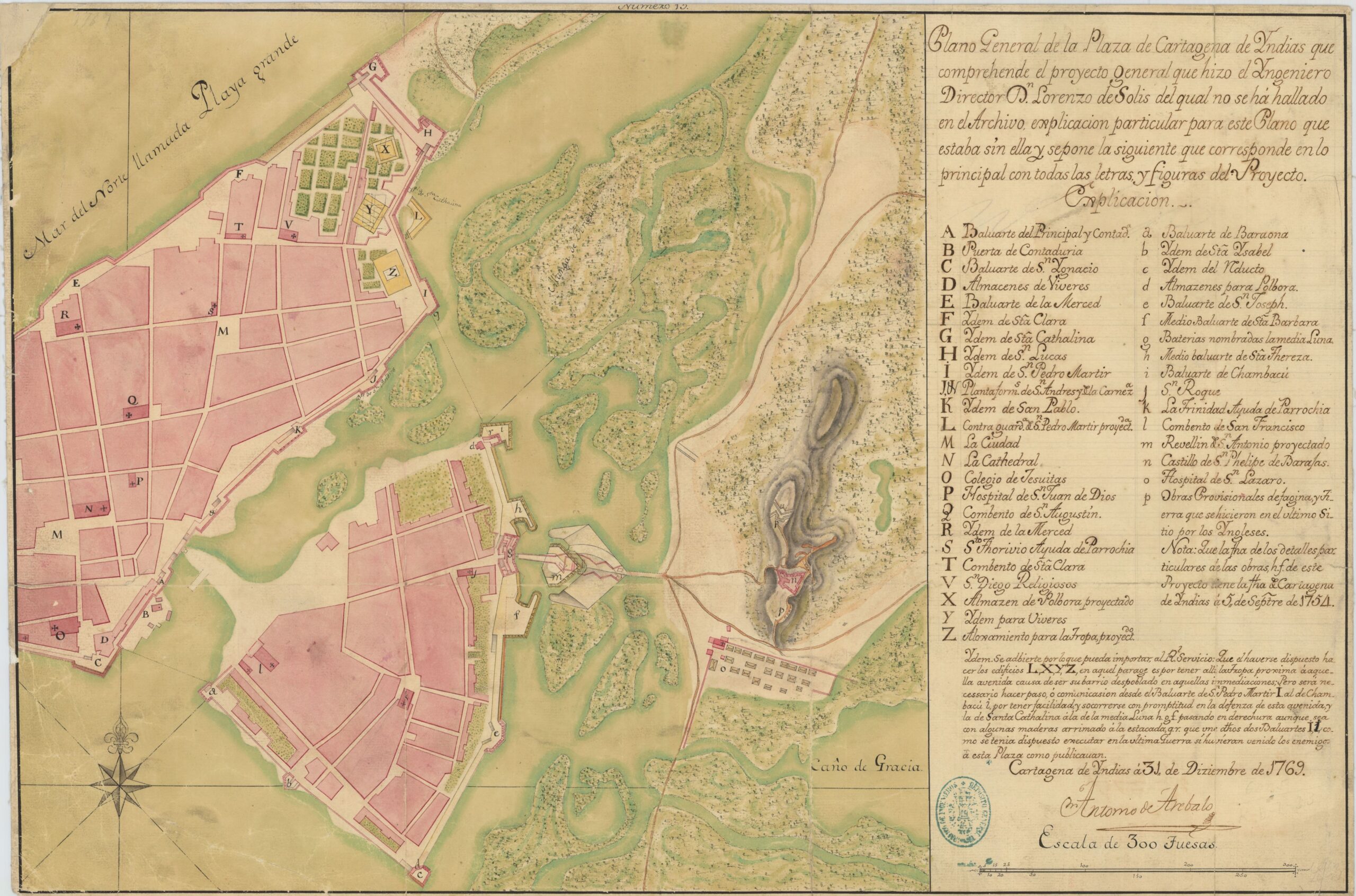
This map, created by Antonio Arévalo y Porras in 1769, depicts the city of Cartagena de Indias, in Colombia.
Cartagena de Indias was one of the main ports of the Spanish colonial era, which made it a target for pirates and English, French and Dutch troops. After Francis Drake's attack in 1586, King Philip II ordered the construction of a wall to protect the city from attack. This work began in 1604 and was completed in 1796, after the publication of this map. In the upper left corner of the map, you can see that the wall connecting the Santa Clara bastion (F) with the Santa Catalina bastion (G) is not yet represented.
The defence system created in Cartagena de Indias was one of the most important and comprehensive in the whole of the Americas. With more than 11 kilometres of walls, it defended the neighbourhoods of the old town (Santa Catalina, Santo Toribio, La Merced and San Sebastián), as well as the suburb of Getsemani, which corresponds to the island at the bottom.
Much of the bastions and walls are still standing, which is one of the reasons why it became the first place in Colombia to be named a UNESCO World Heritage Site in 1984.
Sources

