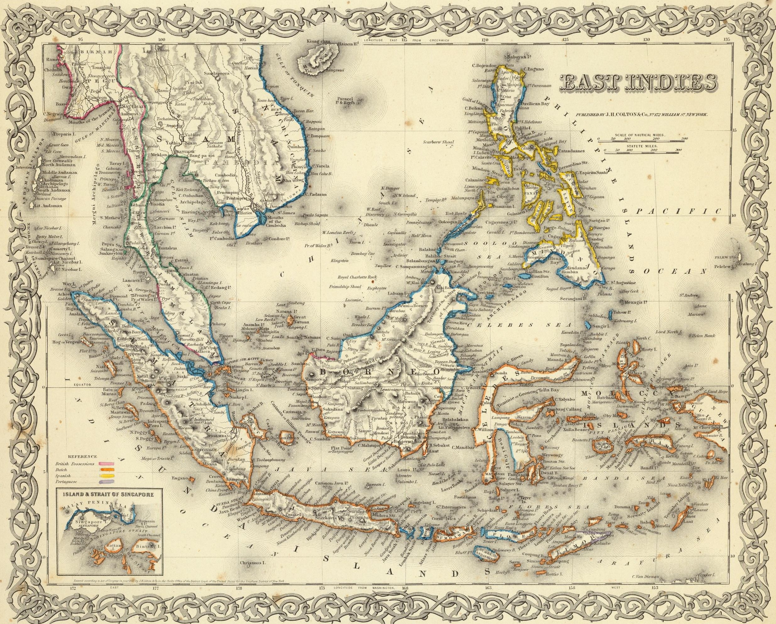
This map was published by George W. Colton in his Atlas of the World in 1856.
The map covers the Malay Archipelago and Indochina, with a colour code showing European possessions in the region:
- Rosa: British colonies, including part of northern Borneo and much of the western coast of Indochina.
- Orange: Dutch colonies, much of present-day Indonesia, with the exception of some islands, partially or totally.
- Yellow: Spanish colonies, much of present-day Philippines.
- Purple: Portuguese colonies, present-day East Timor on the island of Timor (at the bottom right of the map).
The regions shown in blue and green were not considered official colonies of the various European countries at that time. Some of them, such as Siam (now Thailand), avoided colonisation by Western powers through various trade agreements.
Sources

