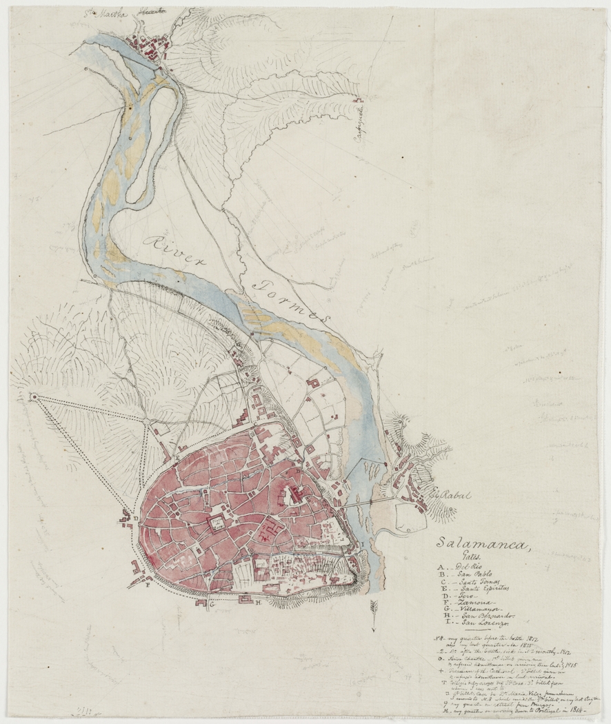
This map of the city of Salamanca, hand-drawn in pencil and coloured using the wash technique, was created by surveyor and cartographer Thomas Mitchell. The map was later used by James Wyld, royal cartographer of the British Empire, as the basis for the map of Salamanca in his work dedicated to the battles fought by the British army during the Spanish War of Independence (1808–1814). It is currently preserved in the State Library of New South Wales, Australia.
The map is oriented with east at the top. Salamanca appears on the north bank of the River Tormes with its city walls still fully preserved. The most important gates in the walls are identified by letters, whose names appear in the legend:
- A) River Gate
- B) St. Paul's Gate
- C) Saint Thomas Gate
- D) Sancti-Spíritus Gate
- E) Gate of the Bull
- F) Zamora Gate
- G) Villamayor Gate
- H) San Bernardo Gate
- I) San Lorenzo Gate
The gates in the wall were almost completely destroyed during the War of Independence, and although the wall remained standing for much of the 19th century, it was gradually dismantled for the most part.
On the map, in addition to Salamanca at the bottom, Santa Marta del Tormes can also be seen at the top.
Sources

