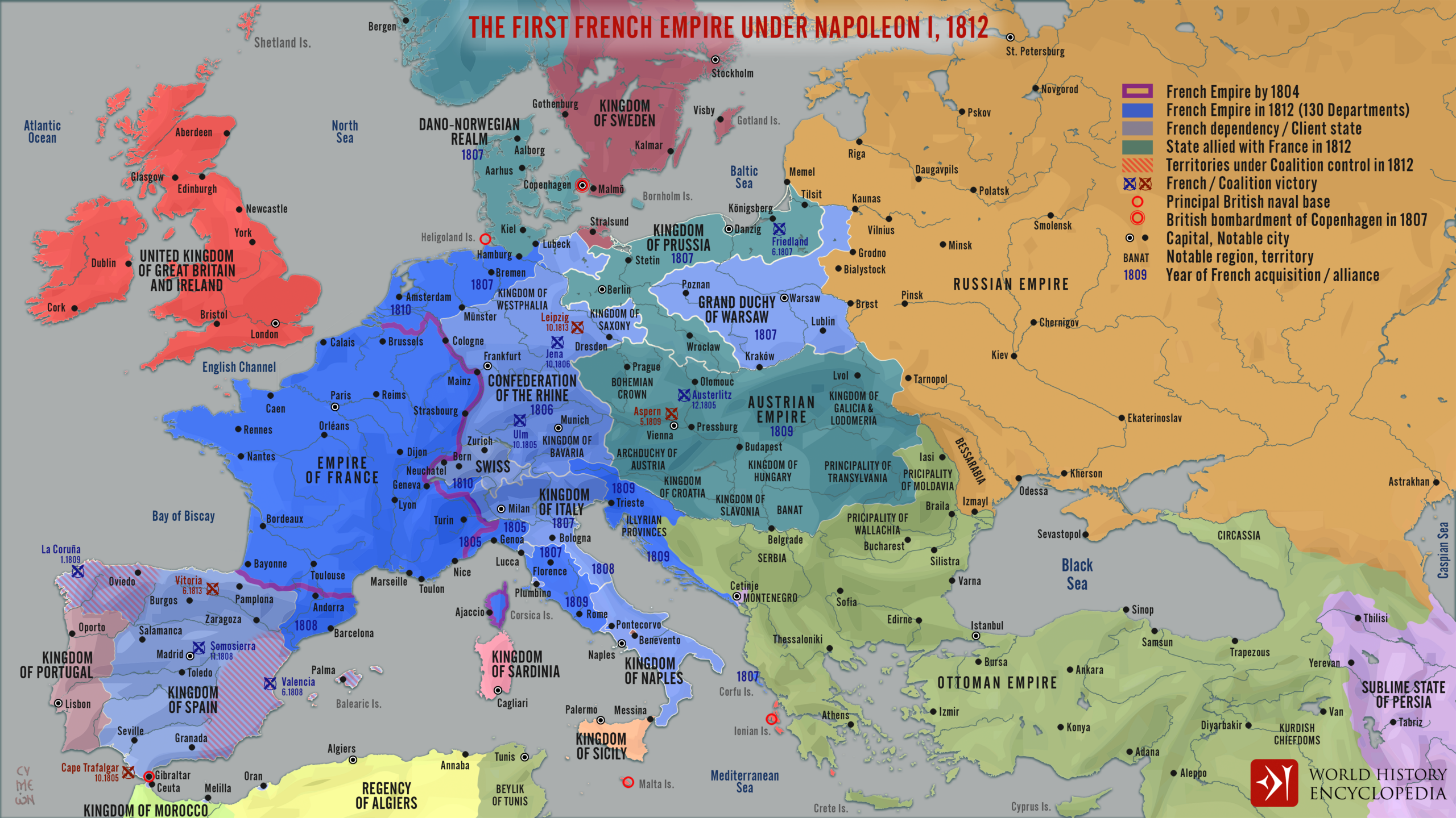
This map, published by Simeon Netchev For World History Encyclopedia, it represents the expansion and heyday of the First French Empire in 1812, with Napoleon Bonaparte at its helm.
The legend provides details about the situation in 1812, as well as progress over the years:
- A purple line shows the extent of the French Empire in 1804.
- In blue, all the possessions of the French Empire in 1812.
- Other territories directly dependent on France in 1812 are shown in light blue, including the Kingdom of Spain, the Confederation of the Rhine, Switzerland, the Kingdom of Italy, the Kingdom of Naples, and the Grand Duchy of Warsaw.
- The countries allied with France in 1812, such as the Austrian Empire, the Kingdom of Prussia, and the Kingdom of Denmark and Norway, are shown in turquoise.
The main battles are marked on the map, with their date and painted in blue when the victory was French, and in red when the victory was for the coalition led by the United Kingdom. British naval bases are also marked with a red circle on the map.
Sources

