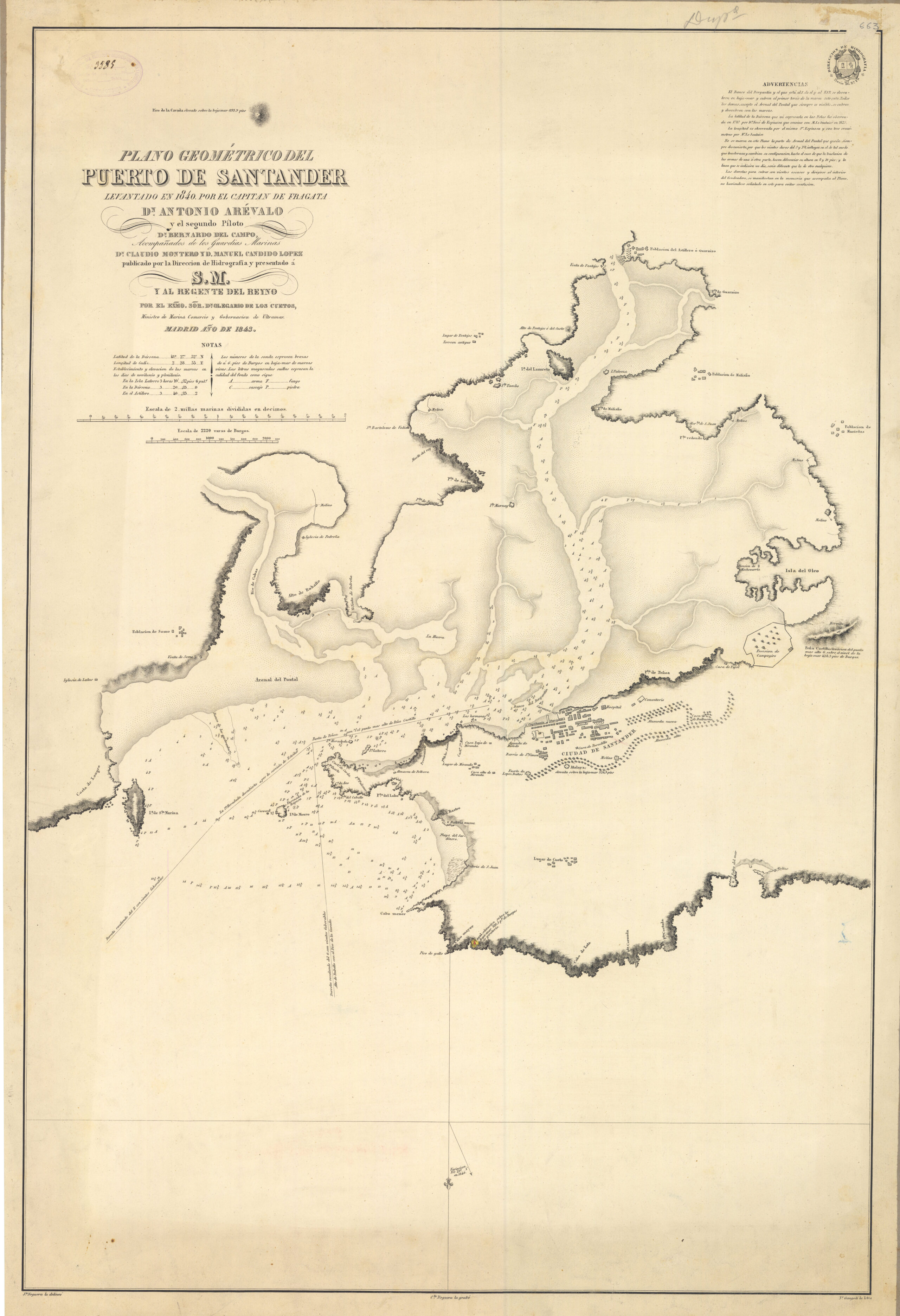
This map, drawn by Antonio Arévalo in 1840, shows the city of Santander with its port and the whole of Santander Bay. It is a study carried out for the Hydrographic Depot, an organisation dedicated to promoting nautical cartography.
The numbers that appear in the bay and at sea are barometric measurements which, when interpreted correctly, enable navigation over shallow waters. The sandbanks and their extent at low tide are also marked in the bay.
The map is drawn with the south at the top. This is why we find the Magdalena peninsula at the bottom, with the city of Santander as it was at that time. On Sardinero Beach, at the tip of the Magdalena Peninsula, there was still no sign of the spa that would make the city popular in the late 19th and early 20th centuries. Construction of the Magdalena spa did not begin until 1878.
Sources

