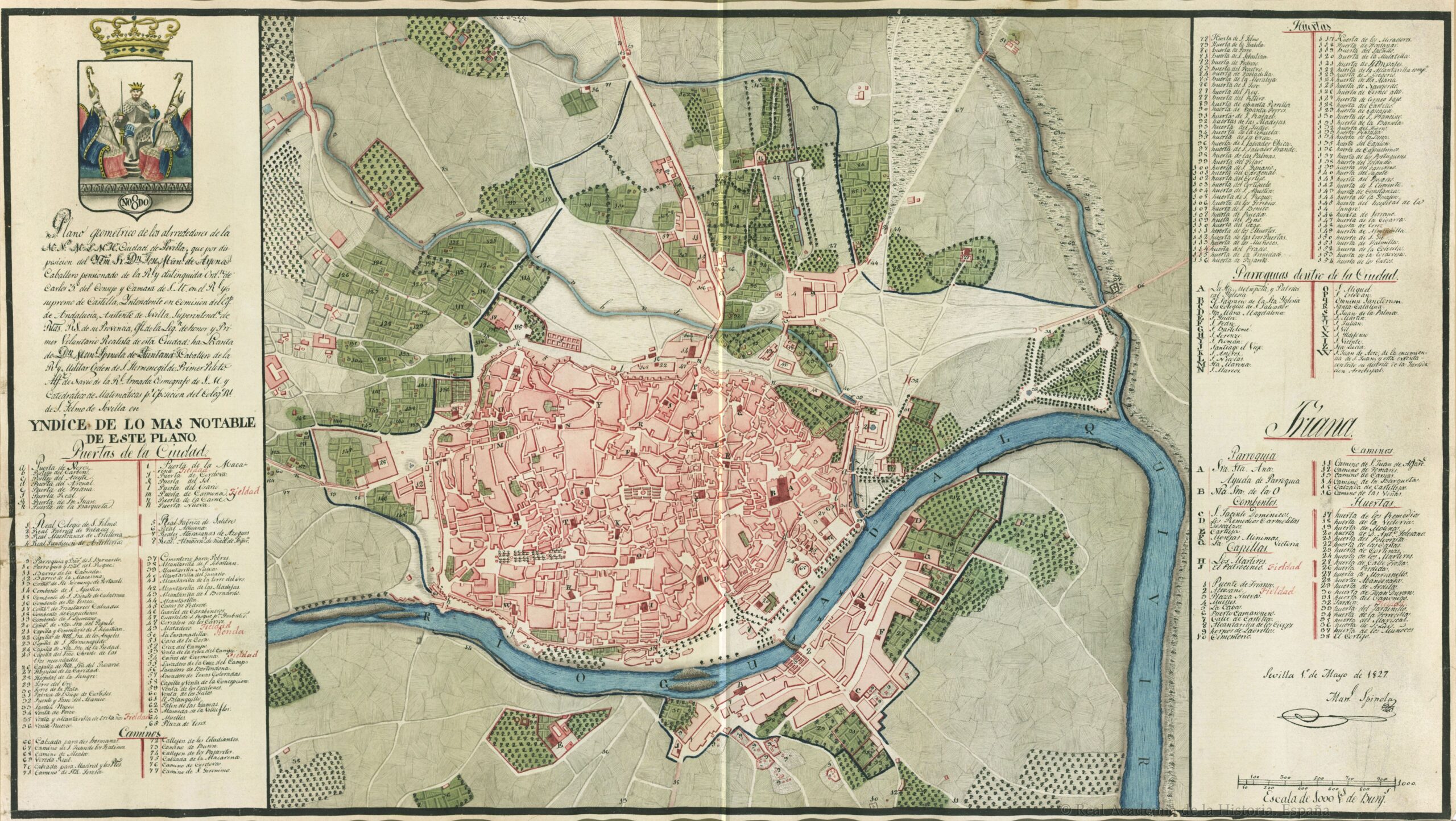
This map, published in 1827 by Manuel Spínola de Quintana, is the first non-military map to depict the urban area of Seville and its immediate surroundings.
This work stems from the importance of establishing and visualising the scope of government of the city of Seville, now beyond the walled area, given the reintroduction of the Right of Gates. To this end, the map shows the total extent of the city with a blue line, placing special emphasis on all buildings linked to access. In the legend, available on both sides of the map, the author marks as fieldad those places that operated as toll booths for the payment of taxes on goods.
In this map, Seville still preserves its entire city wall, and its extension beyond it is limited almost exclusively to the suburb of Triana, to which it is connected by the Triana Bridge. At the time of this map's publication, that bridge was still the Puente de Barcas, built in the 12th century, as the new Isabel II Bridge would not replace it until 1852.
Sources
- Geometric map of the surroundings of the city of Seville
- Map of Seville (1827)
- The urban outskirts of Seville in an unpublished map by Manuel Spínola (1827) | Geographical Studies
.jpg)

