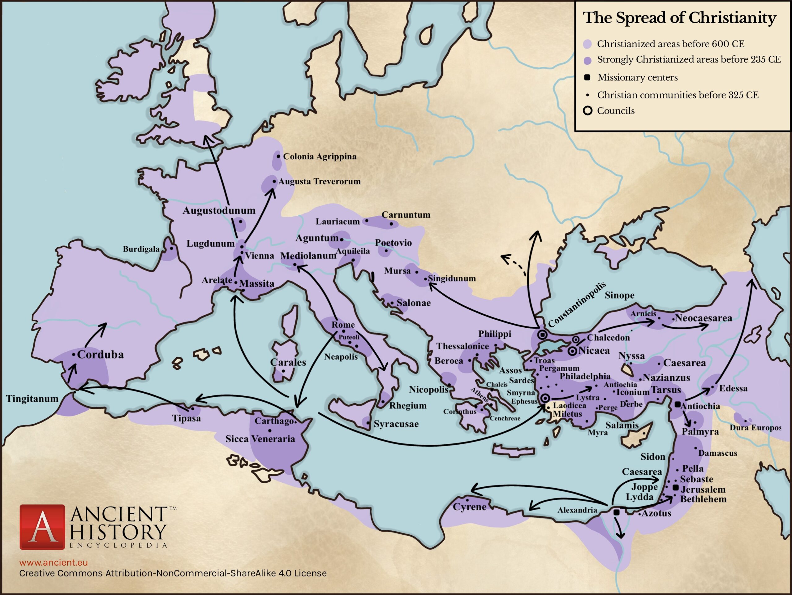
This map, published by Karyna Mykytiuk for World History Encyclopedia, depicts the spread of Christianity in Europe between 325, when the Council of Nicaea, the first council of the Catholic Church, took place, and 600.
Europe had significant Christian communities before the Council of Nicaea, which are marked on the map in dark purple. With the advance of the religion within the Roman Empire and its declaration as the religion of the empire in 380, its expansion reached the confines of Rome, as shown on the map in light purple.
The map also includes the following legend:
- Points: Christian communities in the year 325.
- Circles: Cities that hosted a church council.
- Squares: Missionary centres (Alexandria, Jerusalem, and Antioch).
There is a small error in the illustration: it refers to the year 235 in the caption (in dark purple), when in fact it refers to the year 325.
Sources

