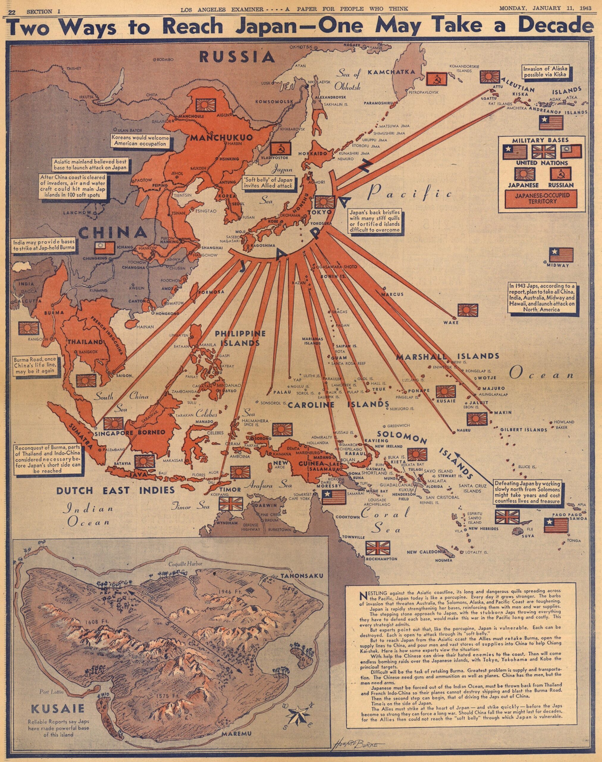
This map was drawn by Howard Burke and published by the Los Angeles Examiner newspaper in 1943, in the context of the Second World War.
The map represents an attempt by an American newspaper to raise awareness among its readers of the great threat posed by the Japanese Empire and its expansion across the Pacific Ocean. To this end, it colours all of Japan's possessions at that time in red and also adds a series of defensive peaks stretching from the Japanese archipelago to all the islands in the Pacific Ocean where they had military bases.
With these points, Burke seeks to liken Japan to a porcupine. In this way, he draws a parallel between how seemingly easy it would be to attack from mainland Asia, “through the porcupine's belly”, and how seemingly complicated it would be to attack from the Pacific Ocean, “through the porcupine's quills”. In this way, he proposes two possible ways to end the conflict, although he clarifies in the text that the continental route could take more than a decade, while the oceanic route could shorten the time frame, which turned out to be true.
In addition, in the lower left corner, the illustration includes a map of Kusaie, now known as Kosrae, an island that is currently part of the Federated States of Micronesia and where Japan was suspected of building its latest Pacific Ocean base.
Sources

