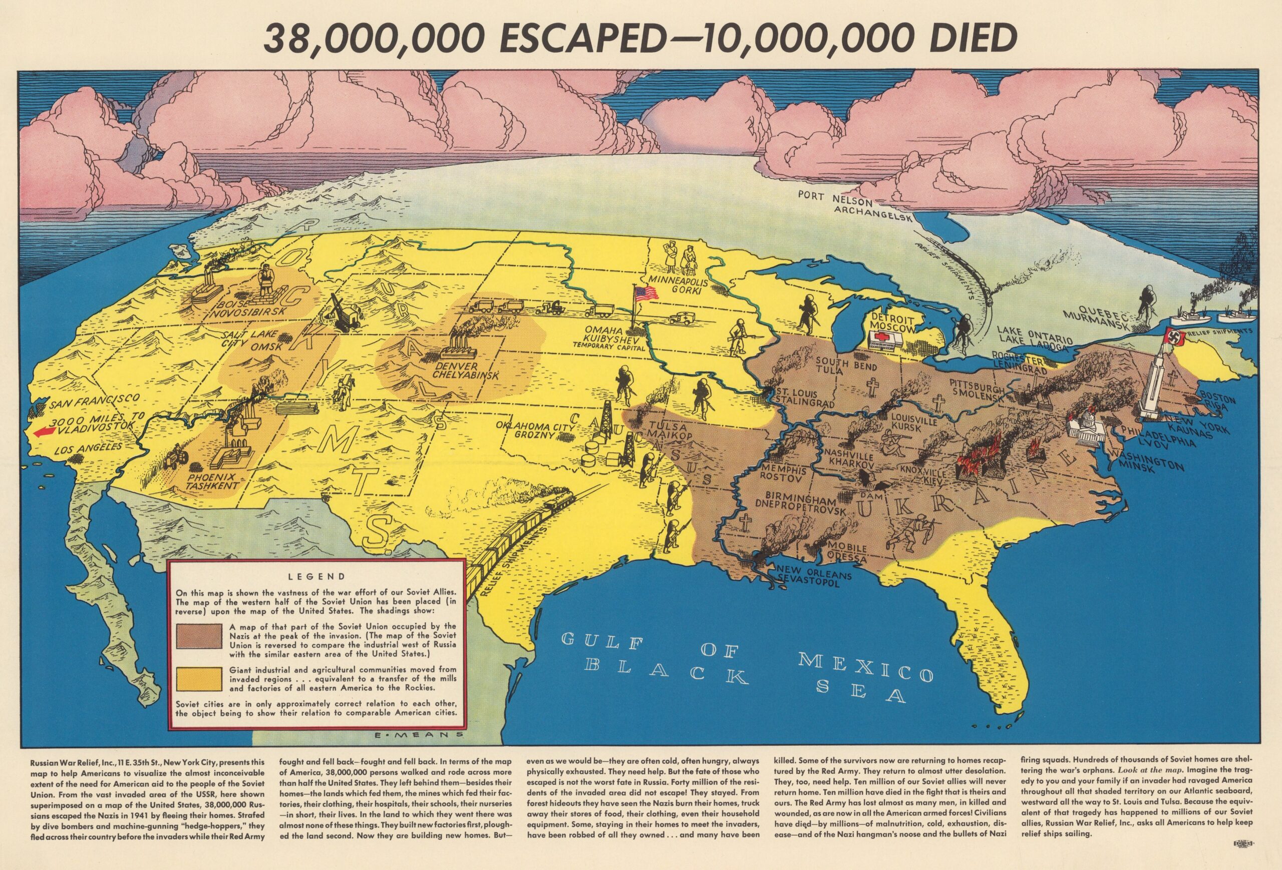
This map, by Elliott Anderson Means, was published by the Russian War Relief organisation in the United States during 1943, in the context of World War II.
Russian War Relief was a humanitarian organisation founded in New York, whose main purpose was to raise funds to help the Soviet population. It was the largest foreign aid agency operating on US soil during World War II, despite being an organisation with Soviet ties. As an uncomfortable agency for many sectors of the US, despite the US-USSR alliance, all of its actions were focused on generating empathy with the situation in Europe.
This map is a typical example of the kind of propaganda promoted by Russian War Relief. In it, one can see a simulation of the impact of the Operation Barbarossa that Nazi Germany had launched on Soviet territory had it been on US territory. The equivalent would mean occupying all the territory painted in brown in the illustration, as well as population shifts to the orange areas, which would act as industrial centres. American cities appear next to the names of Soviet cities, in order to create a direct link between the two states, although the position of these cities was only approximate.
The title also carries an important symbolic weight. Beyond the territorial representation, it openly states the numbers involved in such an invasion of the Soviet Union: 38 million people who had managed to escape and 10 million who had died. In an attempt to add a further point of empathy to the message, at the bottom the text includes a direct interpellation to the readers: Imagine the tragedy if an invader had devastated America all the way to St Louis and Tulsa..
Sources
- 38,000,000 escaped - 10,000,000 died - David Rumsey
- 38,000,000 escaped - 10,000,000,000 died - Norman B. Leventhal
- 38,000,000 Escaped - 10,000,000 Died

 Español
  English (UK)