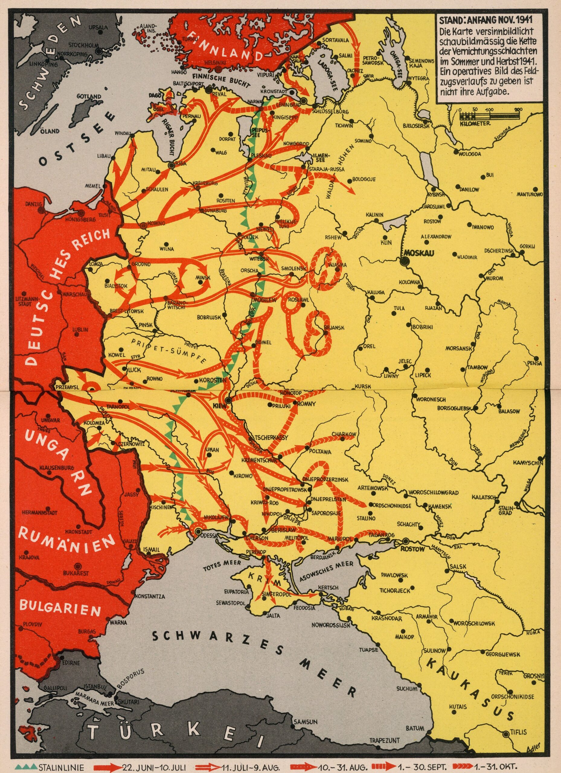
This map was originally published by Ernst Adler in November 1941, showing Nazi Germany's advances between 22 June, when Operation Barbarossa began by surprise, and 31 October. The original copy, in English, was part of a booklet published by the German Information Library in New York. This copy, in German, was reused by Nazi propaganda to show the Wehrmacht's progress in the plan to invade the Soviet Union.
Adler's work clearly aims to show the progress of the German army and the little resistance it was encountering from Soviet troops. Among other things, he highlights in green the position of the Stalin Line and how it had been easily overcome by German troops.
The red arrows, in different shapes, detail the advances throughout the different months. They show how the initial focus of the invasion was the northern area, until Leningrad (now Saint Petersburg) was besieged, and then southwards towards Stalingrad (now Volgograd).
Sources
- Stand: Beginning of November 1941. (to accompany) The War 1939/41 in Maps
- Stand: Early November 1941 – David Rumsey

