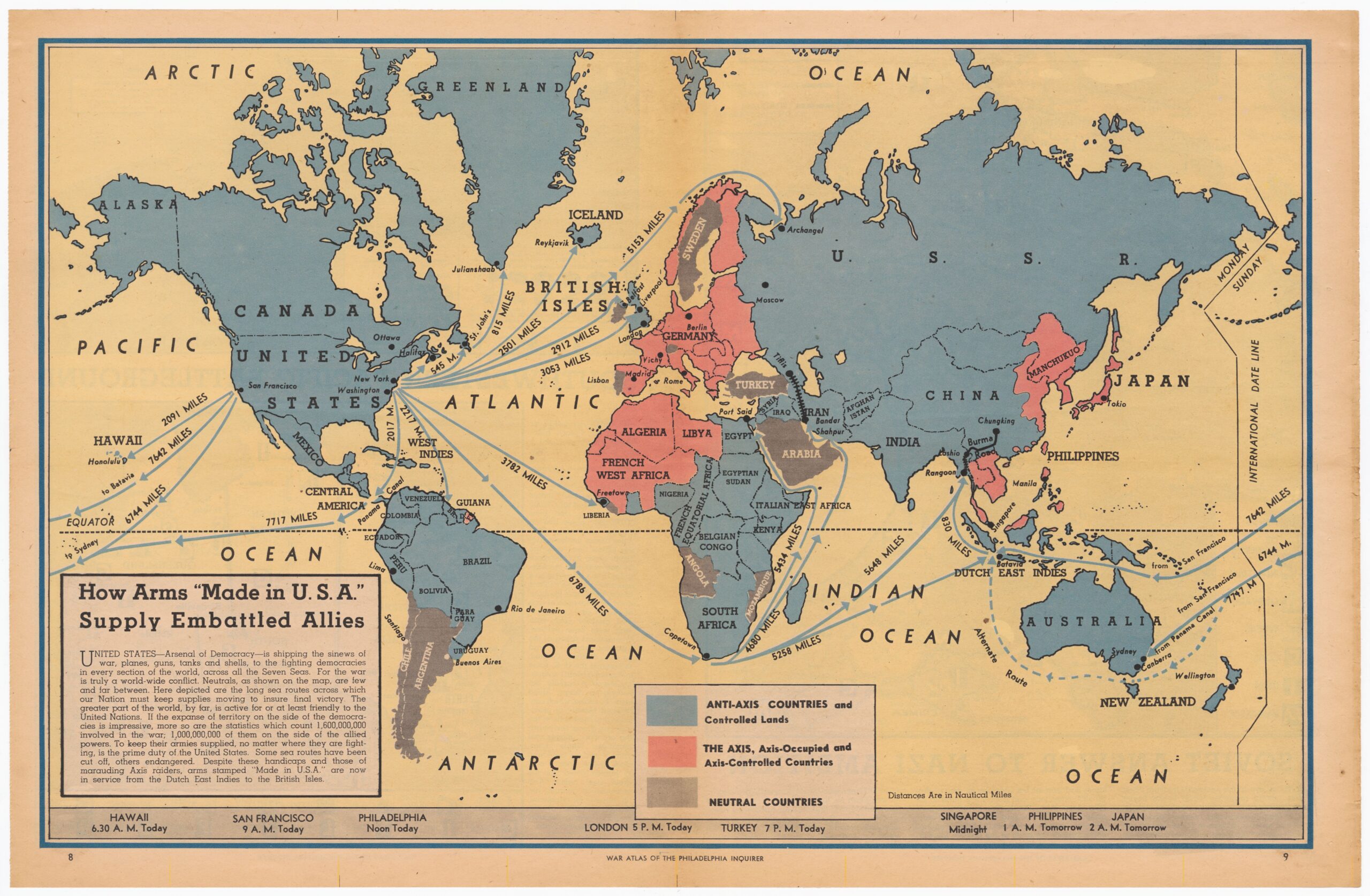
This map, published by the Philadelphia Inquirer In 1942, a few weeks after the attack on Pearl Harbour, it shows a map of the world divided between the Allies, in blue, and the Axis powers, in red.
The map aims to show the great importance of the United States in the conflict as the main supplier of weapons to all the Allied countries, which is reflected in the routes and distances to reach all the Allies in Europe, Africa, Asia and Oceania. The text accompanying the map defines the United States as “the arsenal of democracy”, although the reality is that in 1942 factories were barely producing enough to supply the country and little reached their allies.
It is interesting how, in an attempt to influence public opinion, the newspaper includes several countries and territories that were, to a large extent, officially neutral at the time this map was published. This is the case for much of South America, with countries such as Ecuador, Peru, Venezuela and Uruguay, which only declared war on Germany in 1945, as well as Spain and Afghanistan, which remained neutral until the end of the war.
Sources

