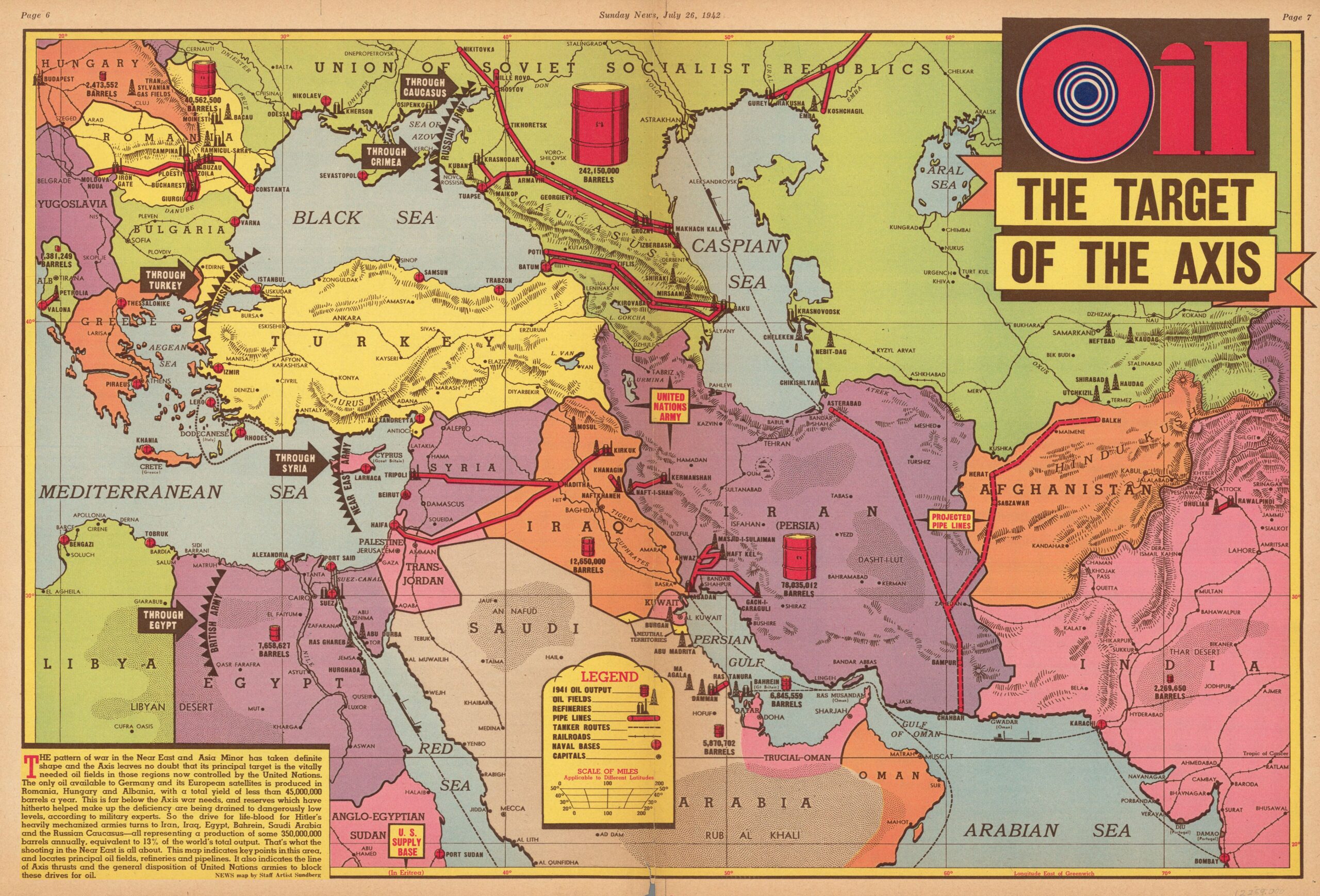
This map was created by Edwin L. Sundberg and published in the American weekly newspaper. Sunday News 26 July 1942, in the context of the Second World War.
This illustration by Sundberg sought to raise readers' awareness of the importance of oil in the Axis Powers' expansion plans. As clarified in the text accompanying the map, in the lower left-hand corner, in 1942 the Axis Powers' only source of oil was limited to the fields in Albania, Hungary and Romania. These had a combined annual production of just 45 million barrels, which was estimated to be far below the needs of Germany and Italy to continue the war.
With this, Sundberg wants to show that there was a risk that the Axis Powers would seek access routes to the large reserves in the Middle East via five different routes:
- Egypt, against the British Empire.
- Cyprus, against the British Empire.
- Turkey, against Turkey.
- Crimea, against the Soviet Union.
- Caucasus, against the Soviet Union.
The map highlights oil production in the region with red barrels of different sizes, emphasising the 242 million barrels produced by the Soviet Union and the 78 million barrels produced by Iran, both well above Romania, Iraq, Egypt, Saudi Arabia and Bahrain. In addition, the map also includes all the oil pipelines, which were key to ensuring the transport of reserves.
Sources

