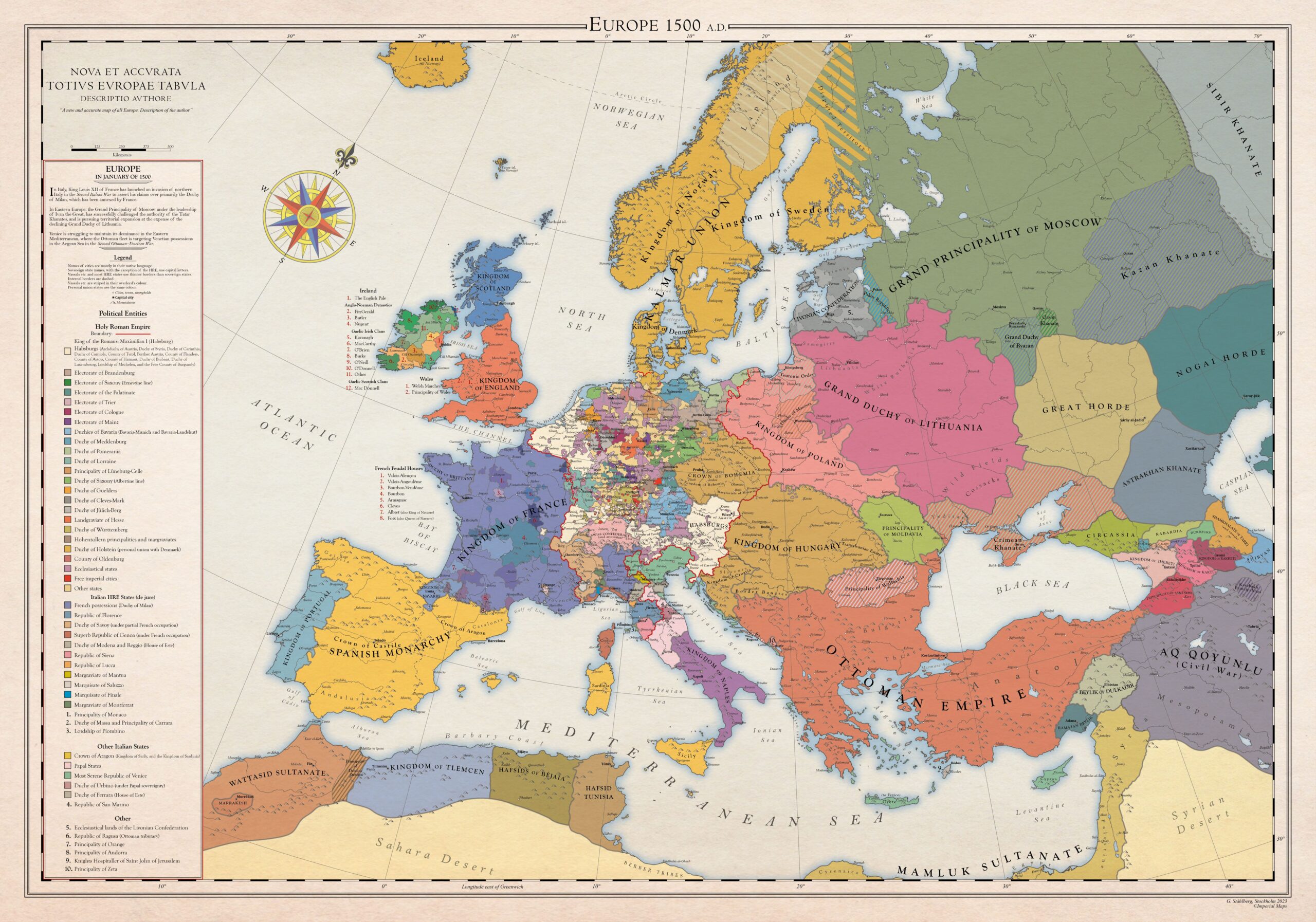
This detailed map, created in 2023 by Gustav Ståhlberg, shows the political situation in Europe in the year 1500.
In Eastern Europe, the Grand Duchy of Moscow, under the leadership of Ivan the Great, was expanding its territory at the expense of the Tatar Khanates and the Grand Duchy of Lithuania. In the south, Venice was fighting the Ottoman Empire to maintain its dominance in the Eastern Mediterranean. In Italy, King Louis XII of France had launched an invasion of northern Italy, which had allowed him to annex the Duchy of Milan.
The map shows the Holy Roman Empire, marked with a red line, which at that time was under the rule of Emperor Maximilian I of Habsburg.
Sources


 Español
  English (UK)