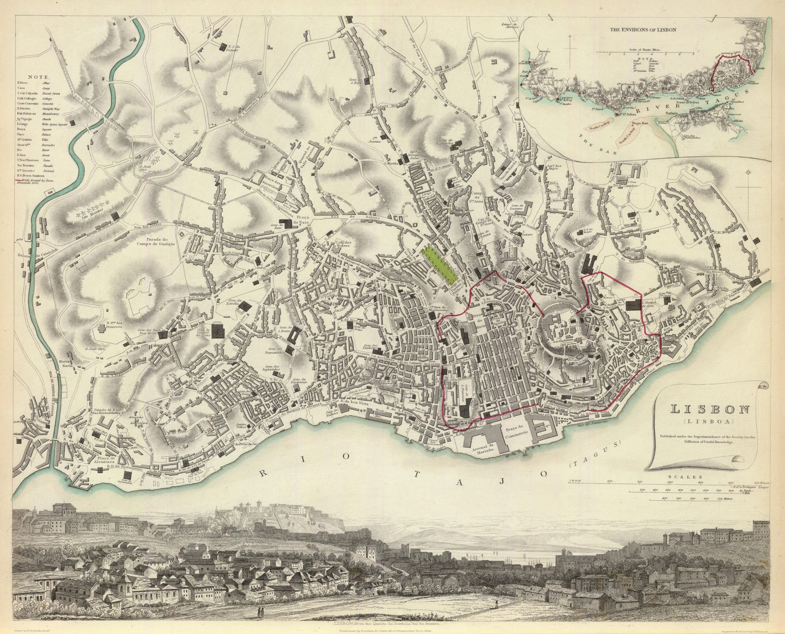
This map was drawn by English cartographer William Barnard Clarke in 1833. It was included in the first volume of Maps from the Society for the Dissemination of Useful Information (Maps of the Society for the Diffusion of Useful Knowledge), a collection of maps for use in the education system and for the dissemination of knowledge, published in 1844.
The map shows the extent of the city at the beginning of the 19th century, which had changed significantly due to the reconstruction carried out after the 1755 earthquake. The old layout of the city's Fernandina walls is marked in red.
At the bottom, the map is accompanied by a drawing of the city from the north towards the River Tagus, which can be seen in the background.
Sources

