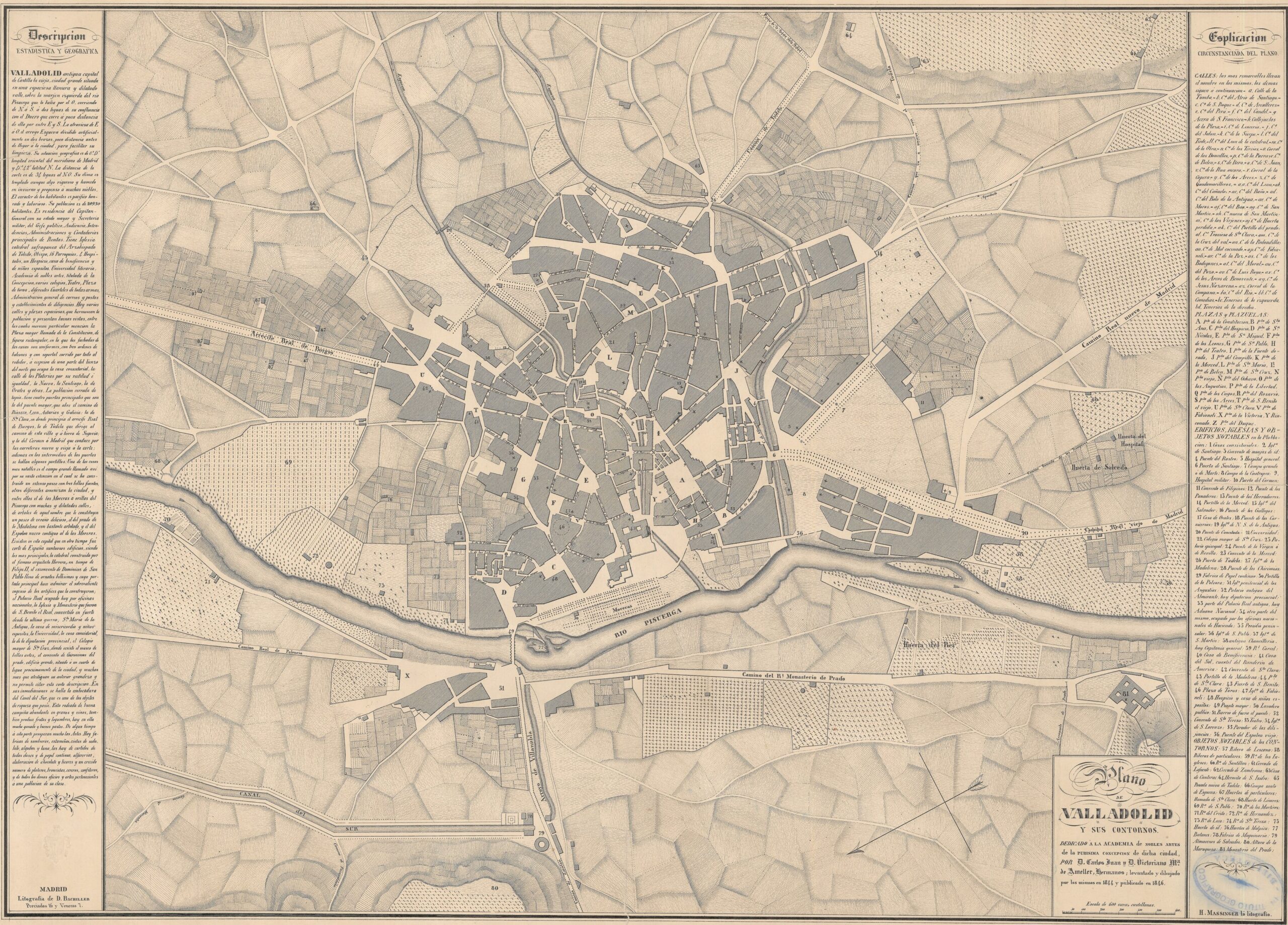
Map of the city of Valladolid drawn by brothers Carlos Juan and Victoriano María de Amaller in 1844 and published two years later by lithographer E. Massinger. An arrow appears in the lower right corner showing the orientation of the map, with north to the left.
The map still shows the two original branches of the Esgueva River as it flows through the city of Valladolid before emptying into the Pisuerga River. Work began on burying the northern branch (on the left of the map) in 1848, and work began on burying the southern branch at the end of the 19th century. Multiple economic problems put this project on hold and, with the need for water sanitation, the creation of a new branch further north (further to the left) was planned to replace the two existing ones, which was built at the beginning of the 20th century.
Sources

